

to cypress
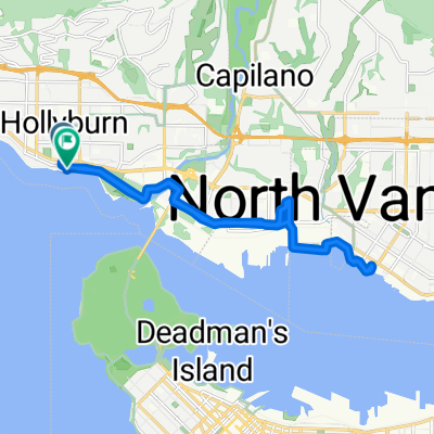
A cycling route starting in West Vancouver, British Columbia, Canada.
Overview
About this route
- 3 h 19 min
- Duration
- 29.6 km
- Distance
- 1,078 m
- Ascent
- 736 m
- Descent
- 8.9 km/h
- Avg. speed
- ---
- Max. altitude

Route quality
Waytypes & surfaces along the route
Waytypes
Road
24.7 km
(83 %)
Quiet road
2.8 km
(9 %)
Surfaces
Paved
12.8 km
(43 %)
Unpaved
0.2 km
(<1 %)
Asphalt
12.8 km
(43 %)
Gravel
0.2 km
(<1 %)
Undefined
16.7 km
(56 %)
Continue with Bikemap
Use, edit, or download this cycling route
You would like to ride to cypress or customize it for your own trip? Here is what you can do with this Bikemap route:
Free features
- Save this route as favorite or in collections
- Copy & plan your own version of this route
- Sync your route with Garmin or Wahoo
Premium features
Free trial for 3 days, or one-time payment. More about Bikemap Premium.
- Navigate this route on iOS & Android
- Export a GPX / KML file of this route
- Create your custom printout (try it for free)
- Download this route for offline navigation
Discover more Premium features.
Get Bikemap PremiumFrom our community
Other popular routes starting in West Vancouver
 Cypress
- Distance
- 15.7 km
- Ascent
- 744 m
- Descent
- 19 m
- Location
- West Vancouver, British Columbia, Canada
 Dam Bur Van
- Distance
- 125.1 km
- Ascent
- 1,780 m
- Descent
- 1,782 m
- Location
- West Vancouver, British Columbia, Canada
 Slow ride in
- Distance
- 17 km
- Ascent
- 0 m
- Descent
- 13 m
- Location
- West Vancouver, British Columbia, Canada
 metro loop first via burnaby mountain
- Distance
- 90.7 km
- Ascent
- 1,205 m
- Descent
- 1,214 m
- Location
- West Vancouver, British Columbia, Canada
 Seymour Dam and Metro Van
- Distance
- 107.7 km
- Ascent
- 1,631 m
- Descent
- 1,629 m
- Location
- West Vancouver, British Columbia, Canada
 Summer 2012 Ride Jasper to Vancouver
- Distance
- 861.9 km
- Ascent
- 3,757 m
- Descent
- 2,701 m
- Location
- West Vancouver, British Columbia, Canada
 Cypress Mountain
- Distance
- 15.2 km
- Ascent
- 823 m
- Descent
- 64 m
- Location
- West Vancouver, British Columbia, Canada
 Cypress Climb
- Distance
- 14 km
- Ascent
- 888 m
- Descent
- 105 m
- Location
- West Vancouver, British Columbia, Canada
Open it in the app