

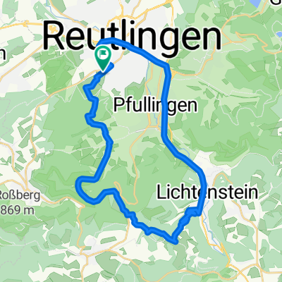
RT-Metzingen-Neuffen-Urach-Eningen-RT
A cycling route starting in Reutlingen, Baden-Wurttemberg, Germany.
Overview
About this route
Über Eningen und Glems nach Metzingen, dort vor der Bahnlinie rechts ab, nach weiteren 300m wieder recht die Weinsteige hoch nach Kohlberg. Von dort aus nach Neuffen, dort die Neuffener Steige hinauf und durchfahren bis nach Grabenstetten. Am Ortseingang rechts runter Richtung Urach (vorbei an der Falkensteiner Höhle). In Urach links ab Richtung Sirchingen. Zu Beginn der Sirchinger Steige rechts ab in die Hanner Steige.
Über St.Johann/Würtingen und vorbei am Fohlenhof die Eninger Steige hinunter und zurück nach RT.
- -:--
- Duration
- 63.8 km
- Distance
- 1,378 m
- Ascent
- 1,216 m
- Descent
- ---
- Avg. speed
- 776 m
- Max. altitude
Route quality
Waytypes & surfaces along the route
Waytypes
Busy road
33.5 km
(53 %)
Road
12.6 km
(20 %)
Surfaces
Paved
54.2 km
(85 %)
Unpaved
1.6 km
(3 %)
Asphalt
51.9 km
(81 %)
Paved (undefined)
2.2 km
(3 %)
Continue with Bikemap
Use, edit, or download this cycling route
You would like to ride RT-Metzingen-Neuffen-Urach-Eningen-RT or customize it for your own trip? Here is what you can do with this Bikemap route:
Free features
- Save this route as favorite or in collections
- Copy & plan your own version of this route
- Sync your route with Garmin or Wahoo
Premium features
Free trial for 3 days, or one-time payment. More about Bikemap Premium.
- Navigate this route on iOS & Android
- Export a GPX / KML file of this route
- Create your custom printout (try it for free)
- Download this route for offline navigation
Discover more Premium features.
Get Bikemap PremiumFrom our community
Other popular routes starting in Reutlingen
 Reutlingen-Nebelhöhle
- Distance
- 29.1 km
- Ascent
- 534 m
- Descent
- 534 m
- Location
- Reutlingen, Baden-Wurttemberg, Germany
 Eninger Weide
- Distance
- 15.8 km
- Ascent
- 414 m
- Descent
- 26 m
- Location
- Reutlingen, Baden-Wurttemberg, Germany
 Reutlingen Nürtingen Wendlingen 32km 110hm
- Distance
- 32.4 km
- Ascent
- 90 m
- Descent
- 217 m
- Location
- Reutlingen, Baden-Wurttemberg, Germany
 Lautertal
- Distance
- 75.8 km
- Ascent
- 952 m
- Descent
- 945 m
- Location
- Reutlingen, Baden-Wurttemberg, Germany
 RT-Metzingen-Neuffen-Urach-Eningen-RT
- Distance
- 63.8 km
- Ascent
- 1,378 m
- Descent
- 1,216 m
- Location
- Reutlingen, Baden-Wurttemberg, Germany
 Albtour
- Distance
- 107.2 km
- Ascent
- 947 m
- Descent
- 950 m
- Location
- Reutlingen, Baden-Wurttemberg, Germany
 Neckartal - Tübingen - Reutlingen
- Distance
- 32.2 km
- Ascent
- 203 m
- Descent
- 214 m
- Location
- Reutlingen, Baden-Wurttemberg, Germany
 Reutlingen - Lindenhof - Holzelfingen - Reutlingen
- Distance
- 32.2 km
- Ascent
- 408 m
- Descent
- 408 m
- Location
- Reutlingen, Baden-Wurttemberg, Germany
Open it in the app