

Rundtour Steinheim - Oppenweiler
A cycling route starting in Steinheim an der Murr, Baden-Wurttemberg, Germany.
Overview
About this route
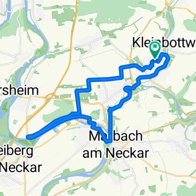
This is a circular route from Steinheim into the Swabian-Franconian Forest near Oppenweiler. The tour includes parts of the local MTB trails 6 and 7.
The route spans 50 km with almost 1000 meters of elevation gain and mostly follows paved or gravel roads and paths, but it also includes trail sections. Since it runs largely through the forest, it is also well rideable in summer.
- -:--
- Duration
- 49.6 km
- Distance
- 661 m
- Ascent
- 661 m
- Descent
- ---
- Avg. speed
- ---
- Max. altitude
Route quality
Waytypes & surfaces along the route
Waytypes
Track
25.8 km
(52 %)
Quiet road
16.4 km
(33 %)
Surfaces
Paved
23.3 km
(47 %)
Unpaved
19.8 km
(40 %)
Asphalt
22.8 km
(46 %)
Gravel
13.9 km
(28 %)
Continue with Bikemap
Use, edit, or download this cycling route
You would like to ride Rundtour Steinheim - Oppenweiler or customize it for your own trip? Here is what you can do with this Bikemap route:
Free features
- Save this route as favorite or in collections
- Copy & plan your own version of this route
- Sync your route with Garmin or Wahoo
Premium features
Free trial for 3 days, or one-time payment. More about Bikemap Premium.
- Navigate this route on iOS & Android
- Export a GPX / KML file of this route
- Create your custom printout (try it for free)
- Download this route for offline navigation
Discover more Premium features.
Get Bikemap PremiumFrom our community
Other popular routes starting in Steinheim an der Murr
 Rund um Höpfigheim
- Distance
- 16.4 km
- Ascent
- 131 m
- Descent
- 124 m
- Location
- Steinheim an der Murr, Baden-Wurttemberg, Germany
 Rundtour Steinheim - Oppenweiler
- Distance
- 49.6 km
- Ascent
- 661 m
- Descent
- 661 m
- Location
- Steinheim an der Murr, Baden-Wurttemberg, Germany
 Winzerhausen-Ottmarsheim-Mundelsheim
- Distance
- 30.1 km
- Ascent
- 305 m
- Descent
- 305 m
- Location
- Steinheim an der Murr, Baden-Wurttemberg, Germany
 Große Traningsrunde
- Distance
- 43.8 km
- Ascent
- 409 m
- Descent
- 417 m
- Location
- Steinheim an der Murr, Baden-Wurttemberg, Germany
 Mittlere Trainingsrunde
- Distance
- 19.6 km
- Ascent
- 84 m
- Descent
- 113 m
- Location
- Steinheim an der Murr, Baden-Wurttemberg, Germany
 Marbach-Freiberg-Markgröningen-Unterriexingen-Bietigheim
- Distance
- 54.3 km
- Ascent
- 504 m
- Descent
- 509 m
- Location
- Steinheim an der Murr, Baden-Wurttemberg, Germany
 Feierabendausfahrt
- Distance
- 36.1 km
- Ascent
- 413 m
- Descent
- 412 m
- Location
- Steinheim an der Murr, Baden-Wurttemberg, Germany
 Weinberge, Wald und Felder
- Distance
- 26.2 km
- Ascent
- 387 m
- Descent
- 376 m
- Location
- Steinheim an der Murr, Baden-Wurttemberg, Germany
Open it in the app