

Hägendorf-Solothurn
A cycling route starting in Hägendorf, Canton of Solothurn, Switzerland.
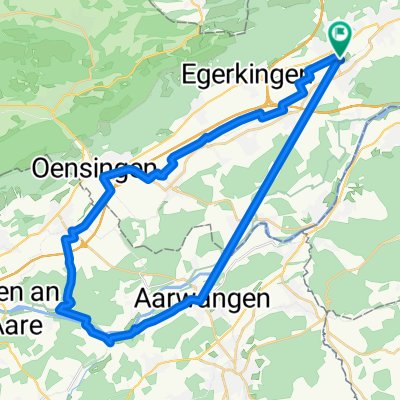
Overview
About this route
Not too steep, beautiful cycle path along the Aare
- -:--
- Duration
- 41.1 km
- Distance
- 257 m
- Ascent
- 251 m
- Descent
- ---
- Avg. speed
- 489 m
- Max. altitude
Route quality
Waytypes & surfaces along the route
Waytypes
Quiet road
10.7 km
(26 %)
Road
9.9 km
(24 %)
Surfaces
Paved
26.3 km
(64 %)
Unpaved
4.5 km
(11 %)
Asphalt
25.5 km
(62 %)
Gravel
3.7 km
(9 %)
Continue with Bikemap
Use, edit, or download this cycling route
You would like to ride Hägendorf-Solothurn or customize it for your own trip? Here is what you can do with this Bikemap route:
Free features
- Save this route as favorite or in collections
- Copy & plan your own version of this route
- Sync your route with Garmin or Wahoo
Premium features
Free trial for 3 days, or one-time payment. More about Bikemap Premium.
- Navigate this route on iOS & Android
- Export a GPX / KML file of this route
- Create your custom printout (try it for free)
- Download this route for offline navigation
Discover more Premium features.
Get Bikemap PremiumFrom our community
Other popular routes starting in Hägendorf
 Moderate Route in Hägendorf
- Distance
- 39.7 km
- Ascent
- 133 m
- Descent
- 134 m
- Location
- Hägendorf, Canton of Solothurn, Switzerland
 Nellenacker 45, Hägendorf nach Bühlweg 1, Hägendorf
- Distance
- 30.6 km
- Ascent
- 217 m
- Descent
- 201 m
- Location
- Hägendorf, Canton of Solothurn, Switzerland
 oberer Hauenstein Baselbiet Benkerjoch
- Distance
- 104.5 km
- Ascent
- 1,376 m
- Descent
- 1,376 m
- Location
- Hägendorf, Canton of Solothurn, Switzerland
 3. Etappe: Kappel - Barbareche
- Distance
- 102.1 km
- Ascent
- 548 m
- Descent
- 349 m
- Location
- Hägendorf, Canton of Solothurn, Switzerland
 Lieblingsroute
- Distance
- 23.9 km
- Ascent
- 602 m
- Descent
- 602 m
- Location
- Hägendorf, Canton of Solothurn, Switzerland
 Langenbruckstrasse 17, Hägendorf nach Langenbruckstrasse 10, Hägendorf
- Distance
- 24.7 km
- Ascent
- 589 m
- Descent
- 585 m
- Location
- Hägendorf, Canton of Solothurn, Switzerland
 Hägendorf Staffelegg Scherz Hägendorf
- Distance
- 91 km
- Ascent
- 864 m
- Descent
- 864 m
- Location
- Hägendorf, Canton of Solothurn, Switzerland
 Chasseral Mt.Crosin Schelten Chilchzimmer
- Distance
- 208.9 km
- Ascent
- 2,754 m
- Descent
- 2,754 m
- Location
- Hägendorf, Canton of Solothurn, Switzerland
Open it in the app