

??£–? nach ??£–?
A cycling route starting in Elsdorf, North Rhine-Westphalia, Germany.
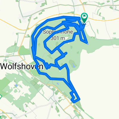
Overview
About this route
- 20 min
- Duration
- 2.4 km
- Distance
- 108 m
- Ascent
- 108 m
- Descent
- 7.4 km/h
- Avg. speed
- ---
- Max. altitude

Continue with Bikemap
Use, edit, or download this cycling route
You would like to ride ??£–? nach ??£–? or customize it for your own trip? Here is what you can do with this Bikemap route:
Free features
- Save this route as favorite or in collections
- Copy & plan your own version of this route
- Sync your route with Garmin or Wahoo
Premium features
Free trial for 3 days, or one-time payment. More about Bikemap Premium.
- Navigate this route on iOS & Android
- Export a GPX / KML file of this route
- Create your custom printout (try it for free)
- Download this route for offline navigation
Discover more Premium features.
Get Bikemap PremiumFrom our community
Other popular routes starting in Elsdorf
 Sophienhöhe flach 19/47km
- Distance
- 19.3 km
- Ascent
- 122 m
- Descent
- 121 m
- Location
- Elsdorf, North Rhine-Westphalia, Germany
 20190217
- Distance
- 44.6 km
- Ascent
- 1,679 m
- Descent
- 1,679 m
- Location
- Elsdorf, North Rhine-Westphalia, Germany
 10. Rennen auf die Sophie
- Distance
- 4.2 km
- Ascent
- 242 m
- Descent
- 49 m
- Location
- Elsdorf, North Rhine-Westphalia, Germany
 Baggerlochschleife
- Distance
- 41.6 km
- Ascent
- 860 m
- Descent
- 870 m
- Location
- Elsdorf, North Rhine-Westphalia, Germany
 Auf der Sophienhöhe
- Distance
- 45.7 km
- Ascent
- 751 m
- Descent
- 751 m
- Location
- Elsdorf, North Rhine-Westphalia, Germany
 sophienhohe
- Distance
- 15 km
- Ascent
- 537 m
- Descent
- 351 m
- Location
- Elsdorf, North Rhine-Westphalia, Germany
 Tagebau Hambach
- Distance
- 52.2 km
- Ascent
- 98 m
- Descent
- 95 m
- Location
- Elsdorf, North Rhine-Westphalia, Germany
 90km
90km- Distance
- 90.6 km
- Ascent
- 146 m
- Descent
- 145 m
- Location
- Elsdorf, North Rhine-Westphalia, Germany
Open it in the app