
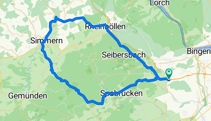
037c MFP Waldlaubersheim - Rheinböllen - Simmern - Holzbach - Tiefenbach - MFP Waldlaubersheim
A cycling route starting in Waldlaubersheim, Rhineland-Palatinate, Germany.
Overview
About this route
Start- & Zielort: Mitfahrerparkplatz Waldlaubersheim
MFP Waldlaubersheim - Schweppenhausen - Stromberg - Rheinböllerhütte - Rheinböllen - Mörschbach - Benzweiler - Rayerschied - Pleizenhausen -> Laubach - Niederkumd - Simmern - Holzbach - Tiefenbach - Kreershäuschen - Münchwald - Spabrücken - Schöneberg - Schweppenhausen - MFP Waldlaubersheim
- -:--
- Duration
- 66.4 km
- Distance
- 884 m
- Ascent
- 884 m
- Descent
- ---
- Avg. speed
- ---
- Max. altitude
Route quality
Waytypes & surfaces along the route
Waytypes
Busy road
38.5 km
(58 %)
Road
15 km
(23 %)
Surfaces
Paved
45.4 km
(68 %)
Unpaved
4.8 km
(7 %)
Asphalt
44.4 km
(67 %)
Ground
3.1 km
(5 %)
Continue with Bikemap
Use, edit, or download this cycling route
You would like to ride 037c MFP Waldlaubersheim - Rheinböllen - Simmern - Holzbach - Tiefenbach - MFP Waldlaubersheim or customize it for your own trip? Here is what you can do with this Bikemap route:
Free features
- Save this route as favorite or in collections
- Copy & plan your own version of this route
- Sync your route with Garmin or Wahoo
Premium features
Free trial for 3 days, or one-time payment. More about Bikemap Premium.
- Navigate this route on iOS & Android
- Export a GPX / KML file of this route
- Create your custom printout (try it for free)
- Download this route for offline navigation
Discover more Premium features.
Get Bikemap PremiumFrom our community
Other popular routes starting in Waldlaubersheim
 052b MFP Waldlaubersheim - Weitersborn - Bruschied - Gemünden - Kreershäuschen - MFP Waldlaubersheim
- Distance
- 86.3 km
- Ascent
- 1,085 m
- Descent
- 1,085 m
- Location
- Waldlaubersheim, Rhineland-Palatinate, Germany
 037a/b MFP Waldlaubersheim - Rheinböllen - Simmern - Ravengiersburg - Tiefenbach - MFP Waldlaubersheim
- Distance
- 80.2 km
- Ascent
- 958 m
- Descent
- 958 m
- Location
- Waldlaubersheim, Rhineland-Palatinate, Germany
 Auslandstour 2017 - Waldlaubersheim Gruppe 3
- Distance
- 58.6 km
- Ascent
- 662 m
- Descent
- 662 m
- Location
- Waldlaubersheim, Rhineland-Palatinate, Germany
 024a Waldlaubersheim - Kreershäuschen - Gemünden - Kellenbachtal - Argenschwang - Waldlaubersheim
- Distance
- 83.6 km
- Ascent
- 1,552 m
- Descent
- 1,485 m
- Location
- Waldlaubersheim, Rhineland-Palatinate, Germany
 037c MFP Waldlaubersheim - Rheinböllen - Simmern - Holzbach - Tiefenbach - MFP Waldlaubersheim
- Distance
- 66.4 km
- Ascent
- 884 m
- Descent
- 884 m
- Location
- Waldlaubersheim, Rhineland-Palatinate, Germany
 Auslandstour 2017 - Waldlaubersheim
- Distance
- 78.5 km
- Ascent
- 918 m
- Descent
- 918 m
- Location
- Waldlaubersheim, Rhineland-Palatinate, Germany
 025c Waldlaubersheim - Stromberg - Dichtelbach - Bacharach - Steeg - Rheinböllen - Waldlaubersheim
- Distance
- 60.4 km
- Ascent
- 958 m
- Descent
- 833 m
- Location
- Waldlaubersheim, Rhineland-Palatinate, Germany
 025b Waldlaubersheim - Forsthaus Neupfalz - Manubach - Bacharach - Steeg - Stromberg - Waldlaubersheim
- Distance
- 64.9 km
- Ascent
- 1,126 m
- Descent
- 1,024 m
- Location
- Waldlaubersheim, Rhineland-Palatinate, Germany
Open it in the app