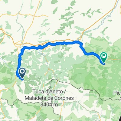
ALTO DEL LAGO DE CAP DE LONG (por Saint-Lary-Soulan)
A cycling route starting in Saint-Lary-Soulan, Languedoc-Roussillon-Midi-Pyrénées, France.
Overview
About this route
- -:--
- Duration
- 22.9 km
- Distance
- 1,372 m
- Ascent
- 15 m
- Descent
- ---
- Avg. speed
- ---
- Avg. speed
Route quality
Waytypes & surfaces along the route
Waytypes
Road
13.6 km
(59 %)
Busy road
8.8 km
(38 %)
Surfaces
Paved
10.4 km
(45 %)
Asphalt
10.4 km
(45 %)
Undefined
12.5 km
(55 %)
Continue with Bikemap
Use, edit, or download this cycling route
You would like to ride ALTO DEL LAGO DE CAP DE LONG (por Saint-Lary-Soulan) or customize it for your own trip? Here is what you can do with this Bikemap route:
Free features
- Save this route as favorite or in collections
- Copy & plan your own version of this route
- Sync your route with Garmin or Wahoo
Premium features
Free trial for 3 days, or one-time payment. More about Bikemap Premium.
- Navigate this route on iOS & Android
- Export a GPX / KML file of this route
- Create your custom printout (try it for free)
- Download this route for offline navigation
Discover more Premium features.
Get Bikemap PremiumFrom our community
Other popular routes starting in Saint-Lary-Soulan
- QV A2M S 4+5 (A)
- Distance
- 207.1 km
- Ascent
- 2,531 m
- Descent
- 2,958 m
- Location
- Saint-Lary-Soulan, Languedoc-Roussillon-Midi-Pyrénées, France
- Saint Lary- Beyrede- Adet
- Distance
- 99.4 km
- Ascent
- 2,641 m
- Descent
- 2,638 m
- Location
- Saint-Lary-Soulan, Languedoc-Roussillon-Midi-Pyrénées, France
- Saint Lary Soulan
- Distance
- 76.6 km
- Ascent
- 2,738 m
- Descent
- 2,740 m
- Location
- Saint-Lary-Soulan, Languedoc-Roussillon-Midi-Pyrénées, France
- Pirenaica11. Saint-Lary-Soulan - Vielha
- Distance
- 105.3 km
- Ascent
- 2,737 m
- Descent
- 2,579 m
- Location
- Saint-Lary-Soulan, Languedoc-Roussillon-Midi-Pyrénées, France
- 10.08.07 Col d´Aspin
- Distance
- 42.3 km
- Ascent
- 1,284 m
- Descent
- 1,284 m
- Location
- Saint-Lary-Soulan, Languedoc-Roussillon-Midi-Pyrénées, France
- Horquet d ancizan-Tourmalet- Aspin
- Distance
- 75.1 km
- Ascent
- 2,713 m
- Descent
- 2,713 m
- Location
- Saint-Lary-Soulan, Languedoc-Roussillon-Midi-Pyrénées, France
- Saint Larye - Peyresourde - Superbagneres
- Distance
- 124.7 km
- Ascent
- 3,412 m
- Descent
- 3,412 m
- Location
- Saint-Lary-Soulan, Languedoc-Roussillon-Midi-Pyrénées, France
- Saint Lary - Peyresourde
- Distance
- 95.2 km
- Ascent
- 2,504 m
- Descent
- 2,506 m
- Location
- Saint-Lary-Soulan, Languedoc-Roussillon-Midi-Pyrénées, France