

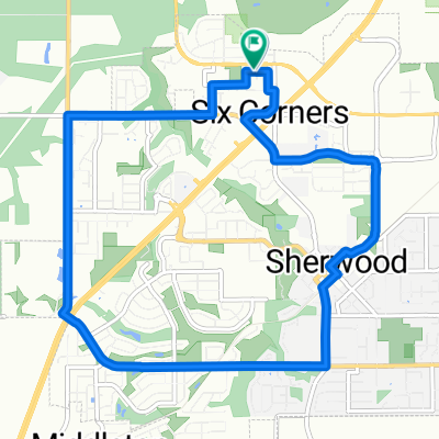
Sherwood
A cycling route starting in Sherwood, Oregon, United States.
Overview
About this route
- -:--
- Duration
- 14.7 km
- Distance
- 68 m
- Ascent
- 74 m
- Descent
- ---
- Avg. speed
- ---
- Max. altitude

Route quality
Waytypes & surfaces along the route
Waytypes
Road
5 km
(34 %)
Quiet road
4.7 km
(32 %)
Surfaces
Paved
3.8 km
(26 %)
Asphalt
1.6 km
(11 %)
Concrete
1.5 km
(10 %)
Route highlights
Points of interest along the route
Point of interest after 12.9 km
Continue with Bikemap
Use, edit, or download this cycling route
You would like to ride Sherwood or customize it for your own trip? Here is what you can do with this Bikemap route:
Free features
- Save this route as favorite or in collections
- Copy & plan your own version of this route
- Sync your route with Garmin or Wahoo
Premium features
Free trial for 3 days, or one-time payment. More about Bikemap Premium.
- Navigate this route on iOS & Android
- Export a GPX / KML file of this route
- Create your custom printout (try it for free)
- Download this route for offline navigation
Discover more Premium features.
Get Bikemap PremiumFrom our community
Other popular routes starting in Sherwood
 Sherwood 65 through Champoeg State Park
- Distance
- 103.1 km
- Ascent
- 619 m
- Descent
- 619 m
- Location
- Sherwood, Oregon, United States
 SW Roy Rogers Rd, Sherwood to 15113 SW Cabernet Dr, Portland
- Distance
- 12.1 km
- Ascent
- 170 m
- Descent
- 65 m
- Location
- Sherwood, Oregon, United States
 DT Sherwood Loop
- Distance
- 9.7 km
- Ascent
- 79 m
- Descent
- 79 m
- Location
- Sherwood, Oregon, United States
 19255 SW Pacific Hwy, Sherwood to 13907 SW Andrew Terr, Tigard
- Distance
- 8.7 km
- Ascent
- 78 m
- Descent
- 49 m
- Location
- Sherwood, Oregon, United States
 Sherwood
- Distance
- 14.7 km
- Ascent
- 68 m
- Descent
- 74 m
- Location
- Sherwood, Oregon, United States
 Chehalem Loop (in progress) 2.0
- Distance
- 105.4 km
- Ascent
- 1,284 m
- Descent
- 1,284 m
- Location
- Sherwood, Oregon, United States

Edge810®
Sherwood Cycling- Distance
- 104.5 km
- Ascent
- 665 m
- Descent
- 683 m
- Location
- Sherwood, Oregon, United States
 Sherwood/Roy Rogers Loop
- Distance
- 12.5 km
- Ascent
- 204 m
- Descent
- 204 m
- Location
- Sherwood, Oregon, United States
Open it in the app