

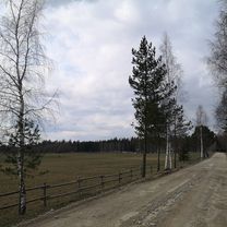
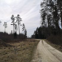
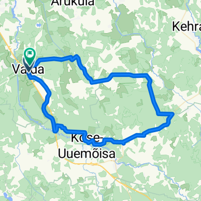
Kose-Paunküla
A cycling route starting in Vaida, Harju, Estonia.
Overview
About this route
- -:--
- Duration
- 68.4 km
- Distance
- 78 m
- Ascent
- 80 m
- Descent
- ---
- Avg. speed
- ---
- Max. altitude

Route quality
Waytypes & surfaces along the route
Waytypes
Road
28.7 km
(42 %)
Quiet road
28.7 km
(42 %)
Surfaces
Paved
33.5 km
(49 %)
Unpaved
20.5 km
(30 %)
Asphalt
32.2 km
(47 %)
Gravel
18.5 km
(27 %)
Continue with Bikemap
Use, edit, or download this cycling route
You would like to ride Kose-Paunküla or customize it for your own trip? Here is what you can do with this Bikemap route:
Free features
- Save this route as favorite or in collections
- Copy & plan your own version of this route
- Sync your route with Garmin or Wahoo
Premium features
Free trial for 3 days, or one-time payment. More about Bikemap Premium.
- Navigate this route on iOS & Android
- Export a GPX / KML file of this route
- Create your custom printout (try it for free)
- Download this route for offline navigation
Discover more Premium features.
Get Bikemap PremiumFrom our community
Other popular routes starting in Vaida
 Oru-Seli ring - 44 km
- Distance
- 44.2 km
- Ascent
- 129 m
- Descent
- 129 m
- Location
- Vaida, Harju, Estonia
 Oja, Kose to Oja, Kose
- Distance
- 19 km
- Ascent
- 49 m
- Descent
- 51 m
- Location
- Vaida, Harju, Estonia
 Oja, Kose to Alu 21, Kose
- Distance
- 14.9 km
- Ascent
- 12 m
- Descent
- 13 m
- Location
- Vaida, Harju, Estonia
 Karla to Karla
- Distance
- 11.1 km
- Ascent
- 50 m
- Descent
- 49 m
- Location
- Vaida, Harju, Estonia
 Route in Rae vald
- Distance
- 55.1 km
- Ascent
- 152 m
- Descent
- 155 m
- Location
- Vaida, Harju, Estonia
 Big Oru ring
- Distance
- 71.9 km
- Ascent
- 77 m
- Descent
- 74 m
- Location
- Vaida, Harju, Estonia
 Kose-Paunküla
- Distance
- 68.4 km
- Ascent
- 78 m
- Descent
- 80 m
- Location
- Vaida, Harju, Estonia
 raja osa 3
- Distance
- 19.2 km
- Ascent
- 24 m
- Descent
- 36 m
- Location
- Vaida, Harju, Estonia
Open it in the app