

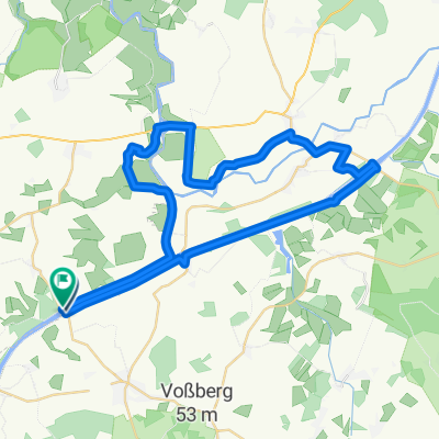
NOK Rundweg Fischerhütte - Hohenhörn
A cycling route starting in Steenfeld, Schleswig-Holstein, Germany.
Overview
About this route
- -:--
- Duration
- 23.7 km
- Distance
- 34 m
- Ascent
- 33 m
- Descent
- ---
- Avg. speed
- 18 m
- Max. altitude
Route quality
Waytypes & surfaces along the route
Waytypes
Track
23.2 km
(98 %)
Cycleway
0.5 km
(2 %)
Surfaces
Paved
23.2 km
(98 %)
Concrete
23.2 km
(98 %)
Undefined
0.5 km
(2 %)
Continue with Bikemap
Use, edit, or download this cycling route
You would like to ride NOK Rundweg Fischerhütte - Hohenhörn or customize it for your own trip? Here is what you can do with this Bikemap route:
Free features
- Save this route as favorite or in collections
- Copy & plan your own version of this route
- Sync your route with Garmin or Wahoo
Premium features
Free trial for 3 days, or one-time payment. More about Bikemap Premium.
- Navigate this route on iOS & Android
- Export a GPX / KML file of this route
- Create your custom printout (try it for free)
- Download this route for offline navigation
Discover more Premium features.
Get Bikemap PremiumFrom our community
Other popular routes starting in Steenfeld
 Offenbüttel - Rendsburg - Offenbüttel
- Distance
- 55.6 km
- Ascent
- 17 m
- Descent
- 14 m
- Location
- Steenfeld, Schleswig-Holstein, Germany
 2019 NOK 2b, Fähre Fischerhütte bis Fähre nach Schafstedt
- Distance
- 12.3 km
- Ascent
- 20 m
- Descent
- 20 m
- Location
- Steenfeld, Schleswig-Holstein, Germany
 Hauptstraße 26, Steenfeld nach Tingskrivervej 7, Kjellerup
- Distance
- 308.9 km
- Ascent
- 1,823 m
- Descent
- 1,785 m
- Location
- Steenfeld, Schleswig-Holstein, Germany
 Brunsbüttel
- Distance
- 66.7 km
- Ascent
- 59 m
- Descent
- 58 m
- Location
- Steenfeld, Schleswig-Holstein, Germany
 Nord- Ostsee Kanal Mitte 1 (32,0km)
- Distance
- 31.6 km
- Ascent
- 4 m
- Descent
- 4 m
- Location
- Steenfeld, Schleswig-Holstein, Germany
 NO Kanal Fischerhütte - Meckelmoor - Lexfähre - Fischerhütte
- Distance
- 42.6 km
- Ascent
- 27 m
- Descent
- 25 m
- Location
- Steenfeld, Schleswig-Holstein, Germany
 Schnittloher Weg 1–13, Steenfeld nach Fährstraße 18–22, Oldenbüttel
- Distance
- 107 km
- Ascent
- 3 m
- Descent
- 17 m
- Location
- Steenfeld, Schleswig-Holstein, Germany
 Hauptstraße 26, Steenfeld nach Hafenstraße 48, Burg (Dithmarschen)
- Distance
- 21.7 km
- Ascent
- 66 m
- Descent
- 67 m
- Location
- Steenfeld, Schleswig-Holstein, Germany
Open it in the app