

RT NEW - Theisseil - Bechtsrieth - Pirk
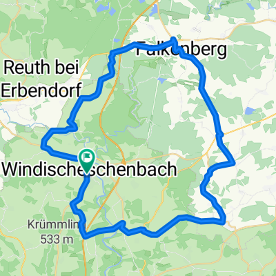
A cycling route starting in Windischeschenbach, Bavaria, Germany.
Overview
About this route
zwischen Edeldorf und Letzau etwas holprig und steil. Der Rest lässt sich ganz gut fahren
- -:--
- Duration
- 55.6 km
- Distance
- 511 m
- Ascent
- 511 m
- Descent
- ---
- Avg. speed
- ---
- Max. altitude
Route quality
Waytypes & surfaces along the route
Waytypes
Quiet road
20.2 km
(36 %)
Track
14.8 km
(27 %)
Surfaces
Paved
42.3 km
(76 %)
Unpaved
13.3 km
(24 %)
Asphalt
40 km
(72 %)
Gravel
7.2 km
(13 %)
Continue with Bikemap
Use, edit, or download this cycling route
You would like to ride RT NEW - Theisseil - Bechtsrieth - Pirk or customize it for your own trip? Here is what you can do with this Bikemap route:
Free features
- Save this route as favorite or in collections
- Copy & plan your own version of this route
- Sync your route with Garmin or Wahoo
Premium features
Free trial for 3 days, or one-time payment. More about Bikemap Premium.
- Navigate this route on iOS & Android
- Export a GPX / KML file of this route
- Create your custom printout (try it for free)
- Download this route for offline navigation
Discover more Premium features.
Get Bikemap PremiumFrom our community
Other popular routes starting in Windischeschenbach
 Wurz-Pressath-Neustadt-Wurz
- Distance
- 55.6 km
- Ascent
- 522 m
- Descent
- 515 m
- Location
- Windischeschenbach, Bavaria, Germany
 win-silb-alte-win
- Distance
- 73.1 km
- Ascent
- 775 m
- Descent
- 778 m
- Location
- Windischeschenbach, Bavaria, Germany
 E- Strecke Stand 27.02.2011
- Distance
- 40 km
- Ascent
- 424 m
- Descent
- 421 m
- Location
- Windischeschenbach, Bavaria, Germany
 C-Strecke PT 2011
- Distance
- 101.7 km
- Ascent
- 1,191 m
- Descent
- 1,192 m
- Location
- Windischeschenbach, Bavaria, Germany
 D 2013
- Distance
- 74.7 km
- Ascent
- 767 m
- Descent
- 770 m
- Location
- Windischeschenbach, Bavaria, Germany
 C 2014
- Distance
- 102.6 km
- Ascent
- 1,094 m
- Descent
- 1,094 m
- Location
- Windischeschenbach, Bavaria, Germany
 B 2015 Entwurf neu
- Distance
- 168.6 km
- Ascent
- 1,334 m
- Descent
- 1,335 m
- Location
- Windischeschenbach, Bavaria, Germany
 B- Strecke PT 2011
- Distance
- 181.9 km
- Ascent
- 1,620 m
- Descent
- 1,620 m
- Location
- Windischeschenbach, Bavaria, Germany
Open it in the app