

Dzień 4 Wleń-Nawojów Łużycki
A cycling route starting in Wleń, Lower Silesian Voivodeship, Poland.
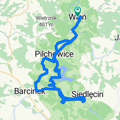
Overview
About this route
W sumie przejechaliśmy tego dnia 65 km.
Prędkość maks. 59,5 km/h
Fatalna pogoda, cały dzień lało
- -:--
- Duration
- 60.7 km
- Distance
- 472 m
- Ascent
- 506 m
- Descent
- ---
- Avg. speed
- ---
- Max. altitude

Route quality
Waytypes & surfaces along the route
Waytypes
Busy road
40.8 km
(67 %)
Road
7.8 km
(13 %)
Surfaces
Paved
52 km
(86 %)
Unpaved
1.6 km
(3 %)
Asphalt
51 km
(84 %)
Paved (undefined)
1 km
(2 %)
Continue with Bikemap
Use, edit, or download this cycling route
You would like to ride Dzień 4 Wleń-Nawojów Łużycki or customize it for your own trip? Here is what you can do with this Bikemap route:
Free features
- Save this route as favorite or in collections
- Copy & plan your own version of this route
- Sync your route with Garmin or Wahoo
Premium features
Free trial for 3 days, or one-time payment. More about Bikemap Premium.
- Navigate this route on iOS & Android
- Export a GPX / KML file of this route
- Create your custom printout (try it for free)
- Download this route for offline navigation
Discover more Premium features.
Get Bikemap PremiumFrom our community
Other popular routes starting in Wleń
 trasa wleń-klecza-radomice-pilchowice- czernica- wleń.
- Distance
- 26.9 km
- Ascent
- 456 m
- Descent
- 459 m
- Location
- Wleń, Lower Silesian Voivodeship, Poland
 Wleń
Wleń- Distance
- 18.3 km
- Ascent
- 319 m
- Descent
- 319 m
- Location
- Wleń, Lower Silesian Voivodeship, Poland
 Wleń - Ostrzyca - Zamkowa Góra
- Distance
- 44 km
- Ascent
- 721 m
- Descent
- 721 m
- Location
- Wleń, Lower Silesian Voivodeship, Poland
 Maciejowiec_Lubomierz_Rębiszów_Kopaniec_Proszowa_Maciejowiec
- Distance
- 74.8 km
- Ascent
- 709 m
- Descent
- 709 m
- Location
- Wleń, Lower Silesian Voivodeship, Poland
 Riesengebirgsvorland
- Distance
- 99.3 km
- Ascent
- 1,062 m
- Descent
- 1,078 m
- Location
- Wleń, Lower Silesian Voivodeship, Poland
 Dolina Bobru
- Distance
- 40.6 km
- Ascent
- 492 m
- Descent
- 492 m
- Location
- Wleń, Lower Silesian Voivodeship, Poland
 Zamek - kingsize - tunel - camping
- Distance
- 6.9 km
- Ascent
- 201 m
- Descent
- 306 m
- Location
- Wleń, Lower Silesian Voivodeship, Poland
 Pilchowie - Jelenia - Pilchowice wzdłuż Bobru
- Distance
- 28.5 km
- Ascent
- 341 m
- Descent
- 341 m
- Location
- Wleń, Lower Silesian Voivodeship, Poland
Open it in the app