

ÄÃÿ÷? nach ÄÃÿ÷?
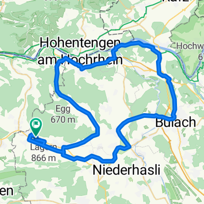
A cycling route starting in Ehrendingen, Canton of Aargau, Switzerland.
Overview
About this route
- 40 min
- Duration
- 9.5 km
- Distance
- 145 m
- Ascent
- 247 m
- Descent
- 14.2 km/h
- Avg. speed
- ---
- Max. altitude

Route quality
Waytypes & surfaces along the route
Waytypes
Quiet road
4.6 km
(48 %)
Busy road
3.1 km
(32 %)
Surfaces
Paved
8.2 km
(87 %)
Unpaved
0.4 km
(4 %)
Asphalt
8.2 km
(87 %)
Gravel
0.3 km
(4 %)
Continue with Bikemap
Use, edit, or download this cycling route
You would like to ride ÄÃÿ÷? nach ÄÃÿ÷? or customize it for your own trip? Here is what you can do with this Bikemap route:
Free features
- Save this route as favorite or in collections
- Copy & plan your own version of this route
- Sync your route with Garmin or Wahoo
Premium features
Free trial for 3 days, or one-time payment. More about Bikemap Premium.
- Navigate this route on iOS & Android
- Export a GPX / KML file of this route
- Create your custom printout (try it for free)
- Download this route for offline navigation
Discover more Premium features.
Get Bikemap PremiumFrom our community
Other popular routes starting in Ehrendingen
 Bülach Kreisel Eglisau Bachsertal Niederweningen
- Distance
- 50 km
- Ascent
- 316 m
- Descent
- 312 m
- Location
- Ehrendingen, Canton of Aargau, Switzerland
 Altberg+Lägern
- Distance
- 37.7 km
- Ascent
- 777 m
- Descent
- 779 m
- Location
- Ehrendingen, Canton of Aargau, Switzerland
 um d Längere
- Distance
- 40.8 km
- Ascent
- 303 m
- Descent
- 312 m
- Location
- Ehrendingen, Canton of Aargau, Switzerland
 Route im Schneckentempo in Regensberg
- Distance
- 13.1 km
- Ascent
- 502 m
- Descent
- 357 m
- Location
- Ehrendingen, Canton of Aargau, Switzerland
 BIKE Wislik.-Fisib.-Bachs-Ehrend.
- Distance
- 37 km
- Ascent
- 553 m
- Descent
- 566 m
- Location
- Ehrendingen, Canton of Aargau, Switzerland
 Wehntal Flughafen Rhein Wehntal
- Distance
- 51 km
- Ascent
- 156 m
- Descent
- 287 m
- Location
- Ehrendingen, Canton of Aargau, Switzerland
 Lengnau Sternnebel
- Distance
- 9.6 km
- Ascent
- 211 m
- Descent
- 78 m
- Location
- Ehrendingen, Canton of Aargau, Switzerland
 20 Freienwil-Glatt-Bachs-Freienwil 60 Km 350 hm
- Distance
- 61.4 km
- Ascent
- 349 m
- Descent
- 349 m
- Location
- Ehrendingen, Canton of Aargau, Switzerland
Open it in the app