

Wolfsried - Öschle/Sulzberger See
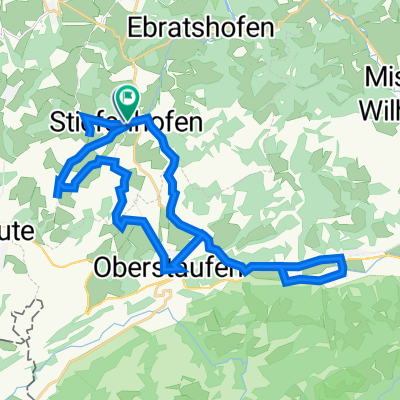
A cycling route starting in Stiefenhofen, Bavaria, Germany.
Overview
About this route
About Missen - Niedersonthofener Lake - Weidach
- -:--
- Duration
- 34.5 km
- Distance
- 561 m
- Ascent
- 631 m
- Descent
- ---
- Avg. speed
- ---
- Max. altitude
Route quality
Waytypes & surfaces along the route
Waytypes
Road
16.2 km
(47 %)
Quiet road
12.1 km
(35 %)
Surfaces
Paved
31.4 km
(91 %)
Unpaved
1 km
(3 %)
Asphalt
31.4 km
(91 %)
Loose gravel
1 km
(3 %)
Undefined
2.1 km
(6 %)
Continue with Bikemap
Use, edit, or download this cycling route
You would like to ride Wolfsried - Öschle/Sulzberger See or customize it for your own trip? Here is what you can do with this Bikemap route:
Free features
- Save this route as favorite or in collections
- Copy & plan your own version of this route
- Sync your route with Garmin or Wahoo
Premium features
Free trial for 3 days, or one-time payment. More about Bikemap Premium.
- Navigate this route on iOS & Android
- Export a GPX / KML file of this route
- Create your custom printout (try it for free)
- Download this route for offline navigation
Discover more Premium features.
Get Bikemap PremiumFrom our community
Other popular routes starting in Stiefenhofen
 bergkäserunde
- Distance
- 31.9 km
- Ascent
- 427 m
- Descent
- 429 m
- Location
- Stiefenhofen, Bavaria, Germany
 Zell 3, Oberstaufen nach Bregenzer Straße 48, Lindau (Bodensee)
- Distance
- 36.9 km
- Ascent
- 358 m
- Descent
- 753 m
- Location
- Stiefenhofen, Bavaria, Germany
 Rund um Oberstaufen
- Distance
- 43.9 km
- Ascent
- 924 m
- Descent
- 924 m
- Location
- Stiefenhofen, Bavaria, Germany
 E2 Königssee
- Distance
- 61.4 km
- Ascent
- 396 m
- Descent
- 317 m
- Location
- Stiefenhofen, Bavaria, Germany
 20170121 Schneeschutour (TRACK)
- Distance
- 11.2 km
- Ascent
- 373 m
- Descent
- 373 m
- Location
- Stiefenhofen, Bavaria, Germany
 Stiefenhofen Bodensee
- Distance
- 74.3 km
- Ascent
- 859 m
- Descent
- 831 m
- Location
- Stiefenhofen, Bavaria, Germany
 Wolfsried - Öschle/Sulzberger See
- Distance
- 34.5 km
- Ascent
- 561 m
- Descent
- 631 m
- Location
- Stiefenhofen, Bavaria, Germany
 Stiefenhofen -Schongau
- Distance
- 113.8 km
- Ascent
- 725 m
- Descent
- 848 m
- Location
- Stiefenhofen, Bavaria, Germany
Open it in the app