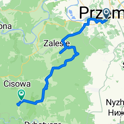
Trasa rowerowa po fortach Twierdzy Przemyśl - całość
- 77.5 km
- 713 m
- 713 m
- Przemyśl, Subcarpathian Voivodeship, Poland
A cycling route starting in Przemyśl, Subcarpathian Voivodeship, Poland.
Overview
The section Chyrzyna-Orlińskie is impassable by bike, overgrown, waterlogged, and unmarked.
created this 15 years ago
Route quality
Quiet road
19.4 km
(33 %)
Track
11.2 km
(19 %)
Paved
35.9 km
(61 %)
Unpaved
1.8 km
(3 %)
Asphalt
35.3 km
(60 %)
Loose gravel
1.2 km
(2 %)
Route highlights
Od miejsca gdzie drogą płynie potok trasa przejezdna tylko kilkadziesiąt metrów. Na końcu drogi należy odbić w lewo stromo do góry prowadząc rower po mocno zarośniętych terenach, często podmokłych.
Po dotarciu na polanę (po zrywce) należy kierować się na połódnie drogami zrywkowymi do szutrówki na Panieński Czub. Od poprzedniego punku informacyjnego do szutrówki trasa niemal w całości nieprzejezdna.
Koniec rajdu na orientację :)
Continue with Bikemap
You would like to ride Eksploracje - 2010/2 or customize it for your own trip? Here is what you can do with this Bikemap route:
Free trial for 3 days, or one-time payment. More about Bikemap Premium.
Discover more Premium features.
Get Bikemap PremiumFrom our community
Open it in the app