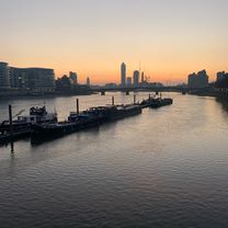
London to Brighton "The Triple Crown"
A cycling route starting in West End of London, England, United Kingdom.
Overview
About this route
LFGSS London to Brighton route planned for 7/8/10.
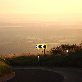
This does all three main climbs into Brighton--Devil's Dyke and Clayton Hill from the seaward side, as well as Ditchling Beacon from the landward side, as often done before on L2B rides.
- -:--
- Duration
- 134.9 km
- Distance
- 665 m
- Ascent
- 678 m
- Descent
- ---
- Avg. speed
- ---
- Max. altitude
Route quality
Waytypes & surfaces along the route
Waytypes
Road
40.5 km
(30 %)
Quiet road
37.8 km
(28 %)
Surfaces
Paved
68.8 km
(51 %)
Unpaved
4 km
(3 %)
Asphalt
62.1 km
(46 %)
Paved (undefined)
5.4 km
(4 %)
Continue with Bikemap
Use, edit, or download this cycling route
You would like to ride London to Brighton "The Triple Crown" or customize it for your own trip? Here is what you can do with this Bikemap route:
Free features
- Save this route as favorite or in collections
- Copy & plan your own version of this route
- Split it into stages to create a multi-day tour
- Sync your route with Garmin or Wahoo
Premium features
Free trial for 3 days, or one-time payment. More about Bikemap Premium.
- Navigate this route on iOS & Android
- Export a GPX / KML file of this route
- Create your custom printout (try it for free)
- Download this route for offline navigation
Discover more Premium features.
Get Bikemap PremiumFrom our community
Other popular routes starting in West End of London
 London Cycle tourist Route
- Distance
- 40.2 km
- Ascent
- 114 m
- Descent
- 114 m
- Location
- West End of London, England, United Kingdom
 Home Route 2 - Westminster Bridge
- Distance
- 15.3 km
- Ascent
- 106 m
- Descent
- 57 m
- Location
- West End of London, England, United Kingdom
 London to Brighton "The Triple Crown"
- Distance
- 134.9 km
- Ascent
- 665 m
- Descent
- 678 m
- Location
- West End of London, England, United Kingdom
 IBIKELDN - get to know London - ride 1 SW CLONED FROM ROUTE 1806304
- Distance
- 42.9 km
- Ascent
- 107 m
- Descent
- 107 m
- Location
- West End of London, England, United Kingdom
 Hyde park, Albert Bridge, Tamise, Westminster, Palais de Buckingham, Oxford street
- Distance
- 10.5 km
- Ascent
- 0 m
- Descent
- 20 m
- Location
- West End of London, England, United Kingdom
 C London to Slough via Richmond Park (quiet)
- Distance
- 84.8 km
- Ascent
- 165 m
- Descent
- 196 m
- Location
- West End of London, England, United Kingdom
 London WNBR 2012 Route
- Distance
- 13.3 km
- Ascent
- 112 m
- Descent
- 111 m
- Location
- West End of London, England, United Kingdom
 regent park, Hightgate, hampstead
- Distance
- 17.6 km
- Ascent
- 146 m
- Descent
- 146 m
- Location
- West End of London, England, United Kingdom
Open it in the app


