slovensko 2015
- 863.1 km
- 1,033 m
- 1,339 m
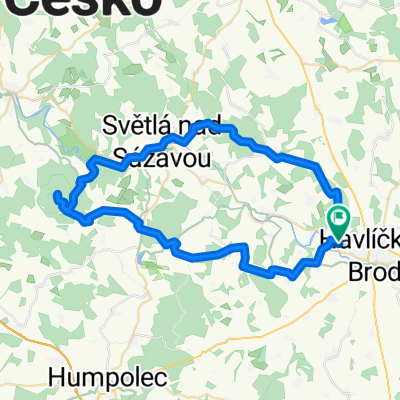
- Havlíčkův Brod, Kraj Vysočina, Czechia
A cycling route starting in Havlíčkův Brod, Kraj Vysočina, Czechia.
Overview
Not too demanding route near HB, nice forest paths around Pelestrov. Amazing panoramic view of Brod nad Veselým Žďárem.
created this 15 years ago
Route quality
Track
9.4 km
(31 %)
Quiet road
6.7 km
(22 %)
Paved
8.2 km
(27 %)
Unpaved
9.1 km
(30 %)
Asphalt
8.2 km
(27 %)
Unpaved (undefined)
3.7 km
(12 %)
Route highlights
Pelestrovská studánka
Pelestrovská hospoda
lesní rybník
nejslepší výhled na Brod a okolí
nejromantičtější vyhlídka
Continue with Bikemap
You would like to ride Na Pelestrov2 or customize it for your own trip? Here is what you can do with this Bikemap route:
Free trial for 3 days, or one-time payment. More about Bikemap Premium.
Discover more Premium features.
Get Bikemap PremiumFrom our community
Open it in the app