

Vallee de la Wolu Rev09
A cycling route starting in Kraainem, Flemish Region, Belgium.
Overview
About this route
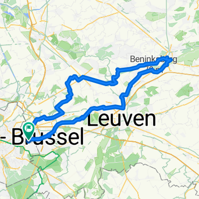
Why follow this route? This course in the heart of an urban area brings together the best wild trails in Wolu Park and the municipalities of Woluwe-St-Lambert, Kraainem, and Zaventem. Ideal for those who want to discover mountain biking right in their neighborhood! It passes through Wolu Park with its few hidden, rooted, and walked trails, the small Schuman woods full of surprises, the trails of Wolu, Hof Ter Muschen and its mill, Molenbos, and Jourdain Park in Kraainem, along with field crossings in Zaventem.Suggested starting points:
-Wolu Park: Wolu footbridge (above Tervuren Avenue)
-Malou Park - Lindekemale Mill
-Marcel Thiry - Large roundabout up top
-Woluwe-St-Etienne - Under the E40 viaduct
-Alma District - In front of EPHEC
-Hof Ter Muschen - On the Wolu trail
-Zaventem - Mariapark (near the swimming pool)
Level: the route is accessible for amateur mountain bikers, with some technical/very steep or physically demanding descents (possible detour), particularly in Wolu Park.
The Kraainem-Zaventem area is more flowy and Woluwe is more technical.
- -:--
- Duration
- 42.2 km
- Distance
- 1,616 m
- Ascent
- 1,561 m
- Descent
- ---
- Avg. speed
- 87 m
- Max. altitude

Continue with Bikemap
Use, edit, or download this cycling route
You would like to ride Vallee de la Wolu Rev09 or customize it for your own trip? Here is what you can do with this Bikemap route:
Free features
- Save this route as favorite or in collections
- Copy & plan your own version of this route
- Sync your route with Garmin or Wahoo
Premium features
Free trial for 3 days, or one-time payment. More about Bikemap Premium.
- Navigate this route on iOS & Android
- Export a GPX / KML file of this route
- Create your custom printout (try it for free)
- Download this route for offline navigation
Discover more Premium features.
Get Bikemap PremiumFrom our community
Other popular routes starting in Kraainem
 Vallee de la Wolu Rev09
- Distance
- 42.2 km
- Ascent
- 1,616 m
- Descent
- 1,561 m
- Location
- Kraainem, Flemish Region, Belgium
 1.5 hours / forest
- Distance
- 32.7 km
- Ascent
- 193 m
- Descent
- 193 m
- Location
- Kraainem, Flemish Region, Belgium
 Lasne Route
- Distance
- 67.1 km
- Ascent
- 347 m
- Descent
- 357 m
- Location
- Kraainem, Flemish Region, Belgium
 Aroung Tervuren and Foret Soignes
- Distance
- 32.1 km
- Ascent
- 231 m
- Descent
- 231 m
- Location
- Kraainem, Flemish Region, Belgium
 Aarschot 86km
- Distance
- 86.5 km
- Ascent
- 238 m
- Descent
- 238 m
- Location
- Kraainem, Flemish Region, Belgium
 Tubize-Louvain
- Distance
- 105.4 km
- Ascent
- 417 m
- Descent
- 411 m
- Location
- Kraainem, Flemish Region, Belgium
 Gravel
- Distance
- 47.2 km
- Ascent
- 107 m
- Descent
- 102 m
- Location
- Kraainem, Flemish Region, Belgium
 Lier 110km NDV
- Distance
- 111.2 km
- Ascent
- 227 m
- Descent
- 240 m
- Location
- Kraainem, Flemish Region, Belgium
Open it in the app