

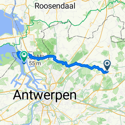
Fotozoektocht 2020 (vanuit Vlimmeren)
A cycling route starting in Oostmalle, Flemish Region, Belgium.
Overview
About this route
- -:--
- Duration
- 20.4 km
- Distance
- 39 m
- Ascent
- 37 m
- Descent
- ---
- Avg. speed
- ---
- Max. altitude
Route quality
Waytypes & surfaces along the route
Waytypes
Quiet road
11.3 km
(56 %)
Cycleway
2.3 km
(11 %)
Surfaces
Paved
11.9 km
(58 %)
Unpaved
4.1 km
(20 %)
Asphalt
4.6 km
(23 %)
Concrete
4.1 km
(20 %)
Continue with Bikemap
Use, edit, or download this cycling route
You would like to ride Fotozoektocht 2020 (vanuit Vlimmeren) or customize it for your own trip? Here is what you can do with this Bikemap route:
Free features
- Save this route as favorite or in collections
- Copy & plan your own version of this route
- Sync your route with Garmin or Wahoo
Premium features
Free trial for 3 days, or one-time payment. More about Bikemap Premium.
- Navigate this route on iOS & Android
- Export a GPX / KML file of this route
- Create your custom printout (try it for free)
- Download this route for offline navigation
Discover more Premium features.
Get Bikemap PremiumFrom our community
Other popular routes starting in Oostmalle
 Test Ride
- Distance
- 34 km
- Ascent
- 67 m
- Descent
- 69 m
- Location
- Oostmalle, Flemish Region, Belgium
 vlimmeren-blankenberge
- Distance
- 32.8 km
- Ascent
- 17 m
- Descent
- 32 m
- Location
- Oostmalle, Flemish Region, Belgium
 Industrieweg 14, Malle naar Mechelsesteenweg 57–95, Antwerpen
- Distance
- 32.9 km
- Ascent
- 34 m
- Descent
- 48 m
- Location
- Oostmalle, Flemish Region, Belgium
 17 bruggen
- Distance
- 77.3 km
- Ascent
- 34 m
- Descent
- 36 m
- Location
- Oostmalle, Flemish Region, Belgium
 06062019 16:16
- Distance
- 11.4 km
- Ascent
- 123 m
- Descent
- 109 m
- Location
- Oostmalle, Flemish Region, Belgium
 Fotozoektocht 2020 (vanuit Vlimmeren)
- Distance
- 20.4 km
- Ascent
- 39 m
- Descent
- 37 m
- Location
- Oostmalle, Flemish Region, Belgium
 oostmalle-tot-high-streets
- Distance
- 60.6 km
- Ascent
- 32 m
- Descent
- 32 m
- Location
- Oostmalle, Flemish Region, Belgium
 Werk 2 via 913
- Distance
- 48.3 km
- Ascent
- 68 m
- Descent
- 77 m
- Location
- Oostmalle, Flemish Region, Belgium
Open it in the app