Velen_Ramsdorf_Oeding_Südl_Gescher_Velen
A cycling route starting in Velen, North Rhine-Westphalia, Germany.
Overview
About this route
- 5 h 18 min
- Duration
- 63.5 km
- Distance
- 88 m
- Ascent
- 88 m
- Descent
- 12 km/h
- Avg. speed
- ---
- Max. altitude
Route photos
Route highlights
Points of interest along the route

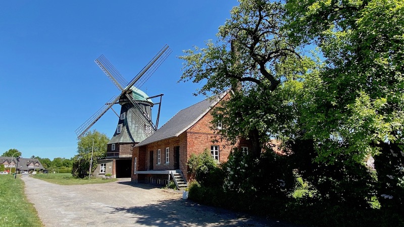
Point of interest after 1.2 km
Sägemühle Gut Ross

Point of interest after 3.5 km
Artesischer Brunnen, Wassertretbecken
Point of interest after 10.9 km
St. Walburga
Point of interest after 17 km
Cafe Späker
Point of interest after 17.7 km
Wassertretbecken

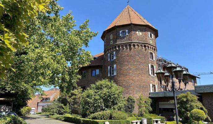
Point of interest after 23.2 km
Burghotel Pass
Point of interest after 29.9 km
Schlinge

Point of interest after 31.9 km
Menke Mühle

Point of interest after 32 km
Menke Mühle
Point of interest after 45.2 km
Berkel

Point of interest after 45.7 km
Berkeltal Gescher

Point of interest after 46.1 km
Point of interest after 50 km
Alte stilgelegte Wassermühle

Point of interest after 50.1 km
Autobahnkapelle - St. Antonius Gescher
Continue with Bikemap
Use, edit, or download this cycling route
You would like to ride Velen_Ramsdorf_Oeding_Südl_Gescher_Velen or customize it for your own trip? Here is what you can do with this Bikemap route:
Free features
- Save this route as favorite or in collections
- Copy & plan your own version of this route
- Sync your route with Garmin or Wahoo
Premium features
Free trial for 3 days, or one-time payment. More about Bikemap Premium.
- Navigate this route on iOS & Android
- Export a GPX / KML file of this route
- Create your custom printout (try it for free)
- Download this route for offline navigation
Discover more Premium features.
Get Bikemap PremiumFrom our community
Other popular routes starting in Velen
 Sonnenwege R5
- Distance
- 37.2 km
- Ascent
- 102 m
- Descent
- 106 m
- Location
- Velen, North Rhine-Westphalia, Germany
 Velen_Ramsdorf_Oeding_Südl_Gescher_Velen
- Distance
- 63.5 km
- Ascent
- 88 m
- Descent
- 88 m
- Location
- Velen, North Rhine-Westphalia, Germany
 Sonnenwege R4
- Distance
- 52.4 km
- Ascent
- 58 m
- Descent
- 60 m
- Location
- Velen, North Rhine-Westphalia, Germany
 Sonnenwege R2
- Distance
- 15.8 km
- Ascent
- 39 m
- Descent
- 39 m
- Location
- Velen, North Rhine-Westphalia, Germany
 2024-04-23 Velen -Borken-Hochmoor-Velen
- Distance
- 52.4 km
- Ascent
- 201 m
- Descent
- 202 m
- Location
- Velen, North Rhine-Westphalia, Germany
 2024-04-22 Velen-Südlohn-Ramsdorf-Velen
- Distance
- 54.2 km
- Ascent
- 93 m
- Descent
- 90 m
- Location
- Velen, North Rhine-Westphalia, Germany
 MTB - Anfänger Route 1
- Distance
- 12.7 km
- Ascent
- 49 m
- Descent
- 47 m
- Location
- Velen, North Rhine-Westphalia, Germany
 Sonnenwege R3
- Distance
- 35.1 km
- Ascent
- 56 m
- Descent
- 29 m
- Location
- Velen, North Rhine-Westphalia, Germany
Open it in the app


