

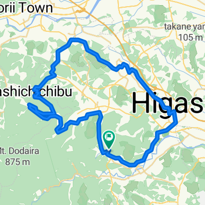
秩父高原牧場サイクリング
A cycling route starting in Ogawamachi, Saitama, Japan.
Overview
About this route
The 'Sky Poppy' in the photo is off course.
- -:--
- Duration
- 45.3 km
- Distance
- 849 m
- Ascent
- 851 m
- Descent
- ---
- Avg. speed
- ---
- Max. altitude

Route photos


Continue with Bikemap
Use, edit, or download this cycling route
You would like to ride 秩父高原牧場サイクリング or customize it for your own trip? Here is what you can do with this Bikemap route:
Free features
- Save this route as favorite or in collections
- Copy & plan your own version of this route
- Sync your route with Garmin or Wahoo
Premium features
Free trial for 3 days, or one-time payment. More about Bikemap Premium.
- Navigate this route on iOS & Android
- Export a GPX / KML file of this route
- Create your custom printout (try it for free)
- Download this route for offline navigation
Discover more Premium features.
Get Bikemap PremiumFrom our community
Other popular routes starting in Ogawamachi
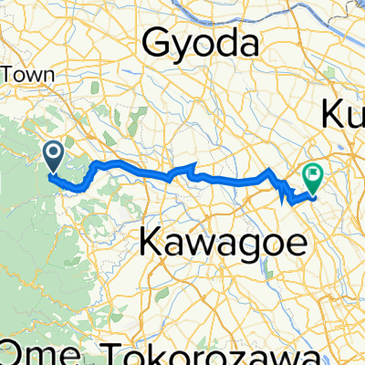
 五明, ときがわ町へ五明, ときがわ町
- Distance
- 47.2 km
- Ascent
- 743 m
- Descent
- 744 m
- Location
- Ogawamachi, Saitama, Japan
 Shiraishi
- Distance
- 6.2 km
- Ascent
- 632 m
- Descent
- 95 m
- Location
- Ogawamachi, Saitama, Japan
 五明, ときがわ町へ五明, ときがわ町
- Distance
- 48.1 km
- Ascent
- 645 m
- Descent
- 645 m
- Location
- Ogawamachi, Saitama, Japan
 秩父高原牧場サイクリング
- Distance
- 45.3 km
- Ascent
- 849 m
- Descent
- 851 m
- Location
- Ogawamachi, Saitama, Japan
 1246-1, Hikage, Tokigawa, Hiki-Gun a 322, Kotobuki 2-Chōme, Ina, Kitaadachi-Gun
- Distance
- 41.2 km
- Ascent
- 112 m
- Descent
- 241 m
- Location
- Ogawamachi, Saitama, Japan
 奥沢61-1, 秩父郡東秩父村 to 小川1199-2, 比企郡小川町
- Distance
- 37.4 km
- Ascent
- 2,499 m
- Descent
- 2,565 m
- Location
- Ogawamachi, Saitama, Japan
 白石-丸山林道-金尾山-松郷峠 80km
- Distance
- 80.2 km
- Ascent
- 2,100 m
- Descent
- 2,098 m
- Location
- Ogawamachi, Saitama, Japan
 45 嵐山の歴史と自然の融合を満喫するルート
- Distance
- 9 km
- Ascent
- 126 m
- Descent
- 139 m
- Location
- Ogawamachi, Saitama, Japan
Open it in the app