

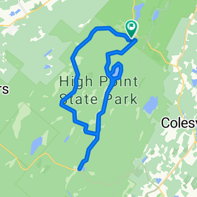
High Point to Cape May
A cycling route starting in Matamoras, Pennsylvania, United States.
Overview
About this route
- -:--
- Duration
- 405.4 km
- Distance
- 376 m
- Ascent
- 903 m
- Descent
- ---
- Avg. speed
- ---
- Max. altitude

Route quality
Waytypes & surfaces along the route
Waytypes
Cycleway
137.8 km
(34 %)
Quiet road
73 km
(18 %)
Surfaces
Paved
60.8 km
(15 %)
Unpaved
113.5 km
(28 %)
Gravel
89.2 km
(22 %)
Asphalt
56.8 km
(14 %)
Continue with Bikemap
Use, edit, or download this cycling route
You would like to ride High Point to Cape May or customize it for your own trip? Here is what you can do with this Bikemap route:
Free features
- Save this route as favorite or in collections
- Copy & plan your own version of this route
- Split it into stages to create a multi-day tour
- Sync your route with Garmin or Wahoo
Premium features
Free trial for 3 days, or one-time payment. More about Bikemap Premium.
- Navigate this route on iOS & Android
- Export a GPX / KML file of this route
- Create your custom printout (try it for free)
- Download this route for offline navigation
Discover more Premium features.
Get Bikemap PremiumFrom our community
Other popular routes starting in Matamoras
 High Point Iris - to Lk Rutherford
- Distance
- 6.3 km
- Ascent
- 142 m
- Descent
- 134 m
- Location
- Matamoras, Pennsylvania, United States
 High Point Iris past Lake R
- Distance
- 7.6 km
- Ascent
- 232 m
- Descent
- 222 m
- Location
- Matamoras, Pennsylvania, United States
 downhill 10k
- Distance
- 10.2 km
- Ascent
- 12 m
- Descent
- 409 m
- Location
- Matamoras, Pennsylvania, United States
 New Jersey
- Distance
- 281.5 km
- Ascent
- 598 m
- Descent
- 747 m
- Location
- Matamoras, Pennsylvania, United States
 41.308, -74.681 to 41.308, -74.681
- Distance
- 30.6 km
- Ascent
- 344 m
- Descent
- 344 m
- Location
- Matamoras, Pennsylvania, United States
 High Point to Cape May
- Distance
- 405.4 km
- Ascent
- 376 m
- Descent
- 903 m
- Location
- Matamoras, Pennsylvania, United States
 High Point Hill Climb
- Distance
- 9.2 km
- Ascent
- 412 m
- Descent
- 35 m
- Location
- Matamoras, Pennsylvania, United States
 Day 4
Day 4- Distance
- 84.8 km
- Ascent
- 734 m
- Descent
- 794 m
- Location
- Matamoras, Pennsylvania, United States
Open it in the app