

Angoulême - Cognac par la Flow Vélo
A cycling route starting in Angoulême, Nouvelle-Aquitaine, France.
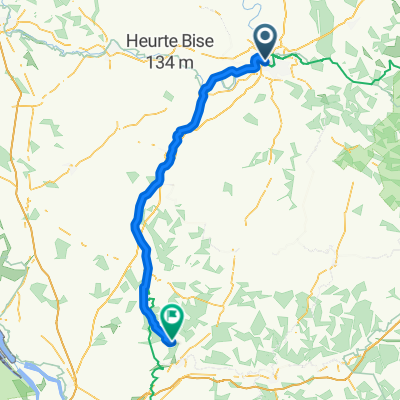
Overview
About this route
Along the Charente
- -:--
- Duration
- 64.3 km
- Distance
- 162 m
- Ascent
- 216 m
- Descent
- ---
- Avg. speed
- ---
- Max. altitude

Route quality
Waytypes & surfaces along the route
Waytypes
Road
35.4 km
(55 %)
Quiet road
13.5 km
(21 %)
Surfaces
Paved
14.8 km
(23 %)
Unpaved
7.1 km
(11 %)
Asphalt
14.1 km
(22 %)
Gravel
6.4 km
(10 %)
Continue with Bikemap
Use, edit, or download this cycling route
You would like to ride Angoulême - Cognac par la Flow Vélo or customize it for your own trip? Here is what you can do with this Bikemap route:
Free features
- Save this route as favorite or in collections
- Copy & plan your own version of this route
- Sync your route with Garmin or Wahoo
Premium features
Free trial for 3 days, or one-time payment. More about Bikemap Premium.
- Navigate this route on iOS & Android
- Export a GPX / KML file of this route
- Create your custom printout (try it for free)
- Download this route for offline navigation
Discover more Premium features.
Get Bikemap PremiumFrom our community
Other popular routes starting in Angoulême
 2020 08 Angouleme-Lagorce
- Distance
- 91.6 km
- Ascent
- 391 m
- Descent
- 384 m
- Location
- Angoulême, Nouvelle-Aquitaine, France
 BVCC Angouleme to Bergerac
- Distance
- 111.6 km
- Ascent
- 700 m
- Descent
- 768 m
- Location
- Angoulême, Nouvelle-Aquitaine, France
 Angoulême - Cognac par la Flow Vélo
- Distance
- 64.3 km
- Ascent
- 162 m
- Descent
- 216 m
- Location
- Angoulême, Nouvelle-Aquitaine, France
 Charente-Landak
- Distance
- 330.4 km
- Ascent
- 225 m
- Descent
- 251 m
- Location
- Angoulême, Nouvelle-Aquitaine, France
 Tour de France
- Distance
- 113.1 km
- Ascent
- 854 m
- Descent
- 873 m
- Location
- Angoulême, Nouvelle-Aquitaine, France
 Balade vélo
- Distance
- 7.7 km
- Ascent
- 81 m
- Descent
- 91 m
- Location
- Angoulême, Nouvelle-Aquitaine, France
 Frankrike dag 11
- Distance
- 101.7 km
- Ascent
- 377 m
- Descent
- 439 m
- Location
- Angoulême, Nouvelle-Aquitaine, France
 Angouleme - Bordeaux
- Distance
- 124.9 km
- Ascent
- 557 m
- Descent
- 593 m
- Location
- Angoulême, Nouvelle-Aquitaine, France
Open it in the app