Baltikum-Belarus 13/17: Мінск (Minsk) - Навагрудак (Navahrudak)
- 143.5 km
- 955 m
- 931 m
- Novoye Medvezhino, Minsk City, Belarus
A cycling route starting in Novoye Medvezhino, Minsk City, Belarus.
Overview
09.06.2019 (Sun.) Minsk (Мінск) - Iwianiec (Івянец) - Nalibaki (Налібакі) - Shchorsy (Щорсы) - Navahrudak (Навагрудак)
This is part of the route from Tallinn via Riga, Vilnius and Minsk to Warsaw. All routes in collection: "Tour: Baltic States - Belarus - Warsaw"
← Baltikum-Belarus 12/17: Мінск (Minsk, Минск) [City Tour]
→ Baltikum-Belarus 14/17: Навагрудак (Navahrudak) - Масты (Masty)
GPS Data:
Distance: 146.25 km | Riding time: 8:28 h | Avg. speed: 17.3 km/h | Max speed: 43.4 km/h | Weather: cloudy in the morning, sunny in the afternoon
Description:
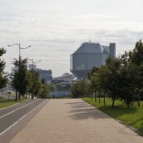
From the 'Orbita' hotel, we head west along the bike path on Pritytskogo Street (vulica Prytyckaha) through an endless jungle of high-rises. The city abruptly ends at the expressway (M9), and you are immediately in the countryside at the village of Degtyarevka, where after rain you can often get stuck in deep mud.
After a few kilometers, we reach road H8932 and follow it to the village of Staroe Selo (Старое Сяло), where we turn left at the Orthodox church onto a side road to the Ptich' River (Пціч). Shortly before the village of Malashki (Малашкі), we leave P65 and labor with fully loaded bikes along the sandy H-9002 to Duličy (Дулічы). From here we continue on an asphalted road beside the M14 highway, which we can cross at Lisovshchina (Лісаўшчына) via an underpass.
On H8988, we proceed to the highest elevation in Belarus, named after Felix Dzerzhinski (Dsjarschynskaja Hara 345 m). Shortly before, we encounter a radar station that seems quite surreal to us.
The straight H8243 leads us north past the village of Volma (Воўма) to Iwianiec (Івянец). Here there are several shops (restaurants are rare throughout Belarus), Orthodox and Catholic churches, a Franciscan monastery, a synagogue, a hostel, and since we are on the former territory of the Polish Republic, there is also a 'Polish House' ('Dom Polski').
From Iwianiec, we ride along 1 May Street, which carries the number H8331 after the town sign. In the village of Petrilovichi (Пятрылавічы), the road becomes a gravel path numbered H9815. We ride through the forest to the ruins of the watermill in Rudnya-Pilnyanskaya on the Usa River (Уса). At the intersection near the watermill, we take the gravel track H9758 to Prudy (Пруды), where the road is asphalted again at the bridge over the Shura River (Шура).
After a few kilometers, we reach the village of Nalibaki (Налібакі) with the adjacent "Nalibozkaja Puschtscha" National Park. The village also entered history through the Nalibaki massacre. At the church in Nalibaki, we turn left and ride about 20 km on a gravel/sand road through the Nalibaki forest. At Kormoran Lake (озеро Кромань), there should be overnight accommodations (camping). Here also runs the border between Minskaja and Hrodsenskaja Woblasz regions.
Only shortly before the bridge over the Memel River, which we meet again on our journey, does the road become asphalted, and within a few minutes we reach the historically significant village of Shchorsy (Щорсы). From here, we continue leisurely under the setting sun through the villages of Njagnevіchy (Нягневічы), Brolniki (Брольнікі), Sulyatichi (Суляцічы) to Nawahradak (Навагрудак), where we find accommodation at Hostel Krokus (Крокус).
created this 6 years ago
 - Навагрудак (Navahrudak)\"")
Route quality
Road
70.3 km
49 %
Quiet road
31.6 km
22 %
Paved
106.2 km
(74 %)
Unpaved
27.3 km
(19 %)
Asphalt
104.8 km
73 %
Gravel
23 km
16 %
Route highlights
 - Навагрудак (Navahrudak)\"")
Cerkiew
Lebensmittel
Radar
Lebensmittel
Dom Polski
Wassermühle
Wolga
Przystanek na piwo
Lebensmittel
Lebensmittel
Kirche
 - Навагрудак (Navahrudak)\"")
Hostel "Krokus" (pl) Właściciele to polska rodzina żyjąca od wieków na Białorusi.
Continue with Bikemap
You would like to ride Baltikum-Belarus 13/17: Мінск (Minsk) - Навагрудак (Navahrudak) or customize it for your own trip? Here is what you can do with this Bikemap route:
Free trial for 3 days, or one-time payment. More about Bikemap Premium.
Discover more Premium features.
Get Bikemap PremiumFrom our community
Open it in the app