

Caterham, Happy Valley
A cycling route starting in Whyteleafe, England, United Kingdom.
Overview
About this route
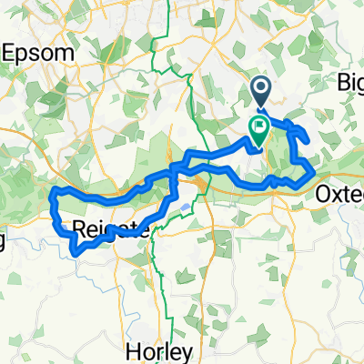
Through caterham on the Hill to The Fox pub. Into happy valley and across to Farthing Down. Left along Ditches Lane to Chaldon, then follow Rook Lane back onto Caterham on the Hill.
- -:--
- Duration
- 10.6 km
- Distance
- 120 m
- Ascent
- 120 m
- Descent
- ---
- Avg. speed
- ---
- Max. altitude
Route quality
Waytypes & surfaces along the route
Waytypes
Quiet road
3.2 km
(30 %)
Busy road
2.6 km
(25 %)
Surfaces
Paved
4.7 km
(45 %)
Unpaved
2 km
(19 %)
Asphalt
4.7 km
(45 %)
Ground
1.3 km
(13 %)
Continue with Bikemap
Use, edit, or download this cycling route
You would like to ride Caterham, Happy Valley or customize it for your own trip? Here is what you can do with this Bikemap route:
Free features
- Save this route as favorite or in collections
- Copy & plan your own version of this route
- Sync your route with Garmin or Wahoo
Premium features
Free trial for 3 days, or one-time payment. More about Bikemap Premium.
- Navigate this route on iOS & Android
- Export a GPX / KML file of this route
- Create your custom printout (try it for free)
- Download this route for offline navigation
Discover more Premium features.
Get Bikemap PremiumFrom our community
Other popular routes starting in Whyteleafe
 93 Buxton Lane, Caterham to 95 Buxton Lane, Caterham
- Distance
- 41.9 km
- Ascent
- 640 m
- Descent
- 642 m
- Location
- Whyteleafe, England, United Kingdom
 Caterham, Pilgrim's Way and Happy Valley
- Distance
- 16.6 km
- Ascent
- 164 m
- Descent
- 207 m
- Location
- Whyteleafe, England, United Kingdom
 Caterham -Reigate
- Distance
- 52.1 km
- Ascent
- 627 m
- Descent
- 599 m
- Location
- Whyteleafe, England, United Kingdom
 Snail-like route in Coulsdon
- Distance
- 20.9 km
- Ascent
- 168 m
- Descent
- 238 m
- Location
- Whyteleafe, England, United Kingdom
 Cycle around Caterham
- Distance
- 11.4 km
- Ascent
- 102 m
- Descent
- 89 m
- Location
- Whyteleafe, England, United Kingdom
 Caterham to Westerham Brewery
- Distance
- 43.2 km
- Ascent
- 323 m
- Descent
- 401 m
- Location
- Whyteleafe, England, United Kingdom
 Surrey_West
- Distance
- 54.2 km
- Ascent
- 442 m
- Descent
- 442 m
- Location
- Whyteleafe, England, United Kingdom
 whyteleaf purley plan
- Distance
- 24.1 km
- Ascent
- 254 m
- Descent
- 289 m
- Location
- Whyteleafe, England, United Kingdom
Open it in the app