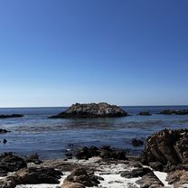
Santa Cruz Pacific Trail
A cycling route starting in Del Monte Forest, California, United States of America.
Overview
About this route
- -:--
- Duration
- 93.4 km
- Distance
- 265 m
- Ascent
- 490 m
- Descent
- ---
- Avg. speed
- ---
- Max. altitude
Route quality
Waytypes & surfaces along the route
Waytypes
Busy road
35.9 km
(38 %)
Cycleway
29.8 km
(32 %)
Surfaces
Paved
47 km
(50 %)
Asphalt
32 km
(34 %)
Paved (undefined)
13.5 km
(14 %)
Continue with Bikemap
Use, edit, or download this cycling route
You would like to ride Santa Cruz Pacific Trail or customize it for your own trip? Here is what you can do with this Bikemap route:
Free features
- Save this route as favorite or in collections
- Copy & plan your own version of this route
- Split it into stages to create a multi-day tour
- Sync your route with Garmin or Wahoo
Premium features
Free trial for 3 days, or one-time payment. More about Bikemap Premium.
- Navigate this route on iOS & Android
- Export a GPX / KML file of this route
- Create your custom printout (try it for free)
- Download this route for offline navigation
Discover more Premium features.
Get Bikemap PremiumFrom our community
Other popular routes starting in Del Monte Forest
- Moderate route in Carmel
- Distance
- 12.3 km
- Ascent
- 248 m
- Descent
- 123 m
- Location
- Del Monte Forest, California, United States of America
- Recovered Route
- Distance
- 6.4 km
- Ascent
- 0 m
- Descent
- 3 m
- Location
- Del Monte Forest, California, United States of America
- Steady ride in Pebble Beach
- Distance
- 15.8 km
- Ascent
- 0 m
- Descent
- 5 m
- Location
- Del Monte Forest, California, United States of America
- Cypress Drive 1518, Del Monte Forest to Lawton Avenue 1216, Pacific Grove
- Distance
- 5.5 km
- Ascent
- 117 m
- Descent
- 57 m
- Location
- Del Monte Forest, California, United States of America
- Santa Cruz Pacific Trail
- Distance
- 93.4 km
- Ascent
- 265 m
- Descent
- 490 m
- Location
- Del Monte Forest, California, United States of America
- Carmel to Carmel Valley
- Distance
- 26.7 km
- Ascent
- 237 m
- Descent
- 194 m
- Location
- Del Monte Forest, California, United States of America
- 17 Mile Drive Route 1
- Distance
- 16 km
- Ascent
- 276 m
- Descent
- 276 m
- Location
- Del Monte Forest, California, United States of America
- 17 Mile Drive Route 2
- Distance
- 22.1 km
- Ascent
- 385 m
- Descent
- 385 m
- Location
- Del Monte Forest, California, United States of America
Open it in the app