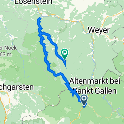
Sankt Gallen - Großraming - Brunnbach - Reichraming
- 56.5 km
- 557 m
- 710 m
- Sankt Gallen, Styria, Austria
A cycling route starting in Sankt Gallen, Styria, Austria.
Overview
created this 5 years ago
Route quality
Quiet road
26.5 km
(47 %)
Road
7.3 km
(13 %)
Paved
17.5 km
(31 %)
Unpaved
6.8 km
(12 %)
Asphalt
17.5 km
(31 %)
Gravel
6.8 km
(12 %)
Undefined
32.2 km
(57 %)
Continue with Bikemap
You would like to ride Sankt Gallen - Großraming - Brunnbach - Reichraming or customize it for your own trip? Here is what you can do with this Bikemap route:
Free trial for 3 days, or one-time payment. More about Bikemap Premium.
Discover more Premium features.
Get Bikemap PremiumFrom our community
Open it in the app