

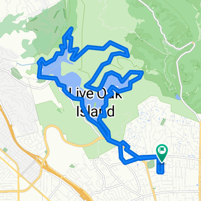
Brandon/Skyline loop
A cycling route starting in Castro Valley, California, United States.
Overview
About this route
- -:--
- Duration
- 18.4 km
- Distance
- 429 m
- Ascent
- 429 m
- Descent
- ---
- Avg. speed
- ---
- Max. altitude

Route quality
Waytypes & surfaces along the route
Waytypes
Road
7.6 km
(41 %)
Quiet road
5.2 km
(28 %)
Surfaces
Paved
2.6 km
(14 %)
Unpaved
2.6 km
(14 %)
Asphalt
2.6 km
(14 %)
Ground
2.6 km
(14 %)
Undefined
13.3 km
(72 %)
Continue with Bikemap
Use, edit, or download this cycling route
You would like to ride Brandon/Skyline loop or customize it for your own trip? Here is what you can do with this Bikemap route:
Free features
- Save this route as favorite or in collections
- Copy & plan your own version of this route
- Sync your route with Garmin or Wahoo
Premium features
Free trial for 3 days, or one-time payment. More about Bikemap Premium.
- Navigate this route on iOS & Android
- Export a GPX / KML file of this route
- Create your custom printout (try it for free)
- Download this route for offline navigation
Discover more Premium features.
Get Bikemap PremiumFrom our community
Other popular routes starting in Castro Valley
 Big Loop around Lake Chabot
- Distance
- 27.1 km
- Ascent
- 489 m
- Descent
- 487 m
- Location
- Castro Valley, California, United States
 Brandon/Skyline loop
- Distance
- 18.4 km
- Ascent
- 429 m
- Descent
- 429 m
- Location
- Castro Valley, California, United States
 Chabot Loop from Nike PL
- Distance
- 20 km
- Ascent
- 584 m
- Descent
- 585 m
- Location
- Castro Valley, California, United States
 LakeChabot_HonkerBayLoop
- Distance
- 11.8 km
- Ascent
- 371 m
- Descent
- 370 m
- Location
- Castro Valley, California, United States
 Castro Valley Circle
- Distance
- 9.5 km
- Ascent
- 76 m
- Descent
- 75 m
- Location
- Castro Valley, California, United States
 Lap of Lake Chabot
- Distance
- 20.7 km
- Ascent
- 330 m
- Descent
- 330 m
- Location
- Castro Valley, California, United States
 Proctor Loop
- Distance
- 8.2 km
- Ascent
- 115 m
- Descent
- 115 m
- Location
- Castro Valley, California, United States
 Big Redwood Loop
- Distance
- 26.2 km
- Ascent
- 474 m
- Descent
- 474 m
- Location
- Castro Valley, California, United States
Open it in the app