

Würzburg - Gemünden: Main Wander Weg - M-Weg
A cycling route starting in Margetshöchheim, Bavaria, Germany.
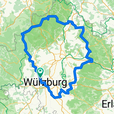
Overview
About this route
Eine MTB Tour von Würzburg bis Gemünden mit ca. 40km Trail auf der Hinfahrt, der Rückweg erfolgt am Main entlang.
Daten des Tacho:
Strecke:100,2km
Höhe: 1191m (hochgefahren)
Daten Gps:
Strecke: 99,6km
Fahrzeit: 5:47:35
Höhenunterschied: 1924m
Gefälle:
-minimal:-20,9%
-maximal:+21,4%
- -:--
- Duration
- 69.9 km
- Distance
- 1,032 m
- Ascent
- 1,031 m
- Descent
- ---
- Avg. speed
- ---
- Avg. speed

Route quality
Waytypes & surfaces along the route
Waytypes
Track
26.7 km
(38 %)
Path
21.5 km
(31 %)
Surfaces
Paved
36.4 km
(52 %)
Unpaved
27.5 km
(39 %)
Asphalt
32.6 km
(47 %)
Ground
14.3 km
(20 %)
Continue with Bikemap
Use, edit, or download this cycling route
You would like to ride Würzburg - Gemünden: Main Wander Weg - M-Weg or customize it for your own trip? Here is what you can do with this Bikemap route:
Free features
- Save this route as favorite or in collections
- Copy & plan your own version of this route
- Sync your route with Garmin or Wahoo
Premium features
Free trial for 3 days, or one-time payment. More about Bikemap Premium.
- Navigate this route on iOS & Android
- Export a GPX / KML file of this route
- Create your custom printout (try it for free)
- Download this route for offline navigation
Discover more Premium features.
Get Bikemap PremiumFrom our community
Other popular routes starting in Margetshöchheim
 2021-4
- Distance
- 84.2 km
- Ascent
- 222 m
- Descent
- 219 m
- Location
- Margetshöchheim, Bavaria, Germany
 2015 Kreuzberg-Tour
- Distance
- 336 km
- Ascent
- 1,258 m
- Descent
- 1,258 m
- Location
- Margetshöchheim, Bavaria, Germany
 Tour 2015
- Distance
- 326 km
- Ascent
- 1,084 m
- Descent
- 1,074 m
- Location
- Margetshöchheim, Bavaria, Germany
 Würzburg - Gemünden: Main Wander Weg - M-Weg
- Distance
- 69.9 km
- Ascent
- 1,032 m
- Descent
- 1,031 m
- Location
- Margetshöchheim, Bavaria, Germany
 Veitshöchheim, Laudenbach hin u. zurück
- Distance
- 35.9 km
- Ascent
- 64 m
- Descent
- 67 m
- Location
- Margetshöchheim, Bavaria, Germany
 Veitshöchheim und Würzburg
- Distance
- 20.7 km
- Ascent
- 182 m
- Descent
- 186 m
- Location
- Margetshöchheim, Bavaria, Germany
 M-Weg-Veitshöchheim
- Distance
- 4.8 km
- Ascent
- 268 m
- Descent
- 94 m
- Location
- Margetshöchheim, Bavaria, Germany
 Berg voraus
- Distance
- 38.7 km
- Ascent
- 565 m
- Descent
- 563 m
- Location
- Margetshöchheim, Bavaria, Germany
Open it in the app