

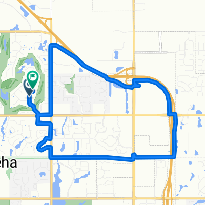
3228 N Oliver St, Wichita to 3228 N Oliver St, Wichita
A cycling route starting in Bellaire, Kansas, United States.
Overview
About this route
- 53 min
- Duration
- 10.8 km
- Distance
- 45 m
- Ascent
- 45 m
- Descent
- 12.3 km/h
- Avg. speed
- ---
- Max. altitude
Continue with Bikemap
Use, edit, or download this cycling route
You would like to ride 3228 N Oliver St, Wichita to 3228 N Oliver St, Wichita or customize it for your own trip? Here is what you can do with this Bikemap route:
Free features
- Save this route as favorite or in collections
- Copy & plan your own version of this route
- Sync your route with Garmin or Wahoo
Premium features
Free trial for 3 days, or one-time payment. More about Bikemap Premium.
- Navigate this route on iOS & Android
- Export a GPX / KML file of this route
- Create your custom printout (try it for free)
- Download this route for offline navigation
Discover more Premium features.
Get Bikemap PremiumFrom our community
Other popular routes starting in Bellaire
 Flagstaff Street
- Distance
- 17.1 km
- Ascent
- 44 m
- Descent
- 42 m
- Location
- Bellaire, Kansas, United States
 3228 N Oliver St, Wichita to 3228 N Oliver St, Wichita
- Distance
- 10.8 km
- Ascent
- 45 m
- Descent
- 45 m
- Location
- Bellaire, Kansas, United States
 Easy ride in Wichita
- Distance
- 11.2 km
- Ascent
- 41 m
- Descent
- 42 m
- Location
- Bellaire, Kansas, United States
 park city jaunt
- Distance
- 17 km
- Ascent
- 52 m
- Descent
- 50 m
- Location
- Bellaire, Kansas, United States
 Push
Push- Distance
- 46.5 km
- Ascent
- 79 m
- Descent
- 78 m
- Location
- Bellaire, Kansas, United States
 Thunder Road
- Distance
- 78 km
- Ascent
- 123 m
- Descent
- 124 m
- Location
- Bellaire, Kansas, United States
 East 32nd Street North
- Distance
- 15 km
- Ascent
- 49 m
- Descent
- 49 m
- Location
- Bellaire, Kansas, United States
 Bel Aire - Wichita
- Distance
- 11.6 km
- Ascent
- 21 m
- Descent
- 36 m
- Location
- Bellaire, Kansas, United States
Open it in the app