

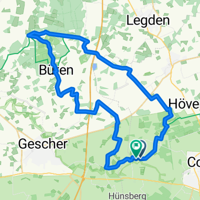
D101-Baumberger-Sandsteinroute-172km
A cycling route starting in Coesfeld, North Rhine-Westphalia, Germany.
Overview
About this route
- -:--
- Duration
- 175.1 km
- Distance
- 408 m
- Ascent
- 410 m
- Descent
- ---
- Avg. speed
- ---
- Max. altitude

Route quality
Waytypes & surfaces along the route
Waytypes
Quiet road
98.1 km
(56 %)
Road
29.8 km
(17 %)
Surfaces
Paved
73.6 km
(42 %)
Unpaved
19.3 km
(11 %)
Asphalt
68.3 km
(39 %)
Gravel
12.3 km
(7 %)
Route highlights
Points of interest along the route
Point of interest after 0.7 km
Berkel
Point of interest after 2.4 km
Fußgängerzone
Point of interest after 2.5 km
Umflut
Point of interest after 6.7 km
Große Kreuzwegkapelle
Point of interest after 12.1 km
Jagdschlösschen im Sirksfeld
Point of interest after 17.2 km
Schloss Valar
Point of interest after 22.4 km
Holtwick
Point of interest after 29.7 km
Osterwick
Point of interest after 35.7 km
Schloss Darfeld
Point of interest after 36.9 km
Darfeld
Point of interest after 40.6 km
Haus Burlo
Point of interest after 54.6 km
St. Ludgerus-Dom in Billerbeck
Point of interest after 55.8 km
Freilichtbühne Billerbeck
Point of interest after 63.2 km
Steinfurter Aa
Point of interest after 73.1 km
Ferienhof Jeiler-Torhaus
Point of interest after 75.1 km
Cafe im Sandsteinmuseum
Point of interest after 76.5 km
St. Dionysius-Kirche in Havixbeck
Point of interest after 76.6 km
Rundfunkmuseum
Point of interest after 81.8 km
Hohenholte
Point of interest after 83.1 km
Münstersche Aa
Point of interest after 88.6 km
Burg Hülshoff
Point of interest after 93.6 km
Schlautbach
Point of interest after 94.9 km
Ponyhof Schleithoff
Point of interest after 95.7 km
Bioland-Gärtnerei Günter Herzkamp
Point of interest after 99.6 km
Das Stift Tilbeck ist eine Einrichtung für Wohnen und Arbeiten am Rande der Gemeinde Havixbeck.
Point of interest after 101.6 km
Schapdetten
Point of interest after 103.6 km
Schulze Hauling Wohnspeicher Heller
Point of interest after 105.9 km
Stever
Point of interest after 106.8 km
A 43
Point of interest after 107.8 km
Appelhülsen
Point of interest after 117 km
St. Martinus in Nottuln
Point of interest after 125.4 km
Schrievers Kuhle, alter Steinbruch. Betreten auf eigene Gefahr
Point of interest after 131.9 km
Ferienpark Baumberge, Gut Holtmann
Point of interest after 139 km
Darup
Point of interest after 148.3 km
Haus Hameren, ehem. zweiteilige Wasserburg in Billerbeck
Point of interest after 166.7 km
Lette
Point of interest after 174.8 km
Parkplatz in Coesfeld
Continue with Bikemap
Use, edit, or download this cycling route
You would like to ride D101-Baumberger-Sandsteinroute-172km or customize it for your own trip? Here is what you can do with this Bikemap route:
Free features
- Save this route as favorite or in collections
- Copy & plan your own version of this route
- Split it into stages to create a multi-day tour
- Sync your route with Garmin or Wahoo
Premium features
Free trial for 3 days, or one-time payment. More about Bikemap Premium.
- Navigate this route on iOS & Android
- Export a GPX / KML file of this route
- Create your custom printout (try it for free)
- Download this route for offline navigation
Discover more Premium features.
Get Bikemap PremiumFrom our community
Other popular routes starting in Coesfeld
 Von Coesfeld bis Menden (Sauerland)
- Distance
- 95.6 km
- Ascent
- 438 m
- Descent
- 356 m
- Location
- Coesfeld, North Rhine-Westphalia, Germany
 D101-Baumberger-Sandsteinroute-172km
- Distance
- 175.1 km
- Ascent
- 408 m
- Descent
- 410 m
- Location
- Coesfeld, North Rhine-Westphalia, Germany
 Route in Coesfeld
- Distance
- 36.4 km
- Ascent
- 163 m
- Descent
- 161 m
- Location
- Coesfeld, North Rhine-Westphalia, Germany
 RTF Coesfeld 112km 2009
- Distance
- 115.5 km
- Ascent
- 500 m
- Descent
- 490 m
- Location
- Coesfeld, North Rhine-Westphalia, Germany
 Goxel-Gaststätte Rappers
- Distance
- 12.9 km
- Ascent
- 43 m
- Descent
- 54 m
- Location
- Coesfeld, North Rhine-Westphalia, Germany
 Heide 25.08.13
- Distance
- 22.2 km
- Ascent
- 97 m
- Descent
- 95 m
- Location
- Coesfeld, North Rhine-Westphalia, Germany
 Benny's Baumbergetocht
- Distance
- 92.2 km
- Ascent
- 719 m
- Descent
- 719 m
- Location
- Coesfeld, North Rhine-Westphalia, Germany
 KREUZWEG TOUR
- Distance
- 15.5 km
- Ascent
- 48 m
- Descent
- 46 m
- Location
- Coesfeld, North Rhine-Westphalia, Germany
Open it in the app