

20150822_小山町サイクリングマップ チャレンジコース
A cycling route starting in Gotemba, Shizuoka, Japan.
Overview
About this route
by
- 7 h 20 min
- Duration
- 43.9 km
- Distance
- 1,522 m
- Ascent
- 1,523 m
- Descent
- 6 km/h
- Avg. speed
- ---
- Max. altitude

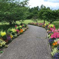
Route photos


Route quality
Waytypes & surfaces along the route
Waytypes
Road
11 km
(25 %)
Quiet road
2.6 km
(6 %)
Surfaces
Paved
9.2 km
(21 %)
Asphalt
7.5 km
(17 %)
Paved (undefined)
1.8 km
(4 %)
Undefined
34.7 km
(79 %)
Continue with Bikemap
Use, edit, or download this cycling route
You would like to ride 20150822_小山町サイクリングマップ チャレンジコース or customize it for your own trip? Here is what you can do with this Bikemap route:
Free features
- Save this route as favorite or in collections
- Copy & plan your own version of this route
- Sync your route with Garmin or Wahoo
Premium features
Free trial for 3 days, or one-time payment. More about Bikemap Premium.
- Navigate this route on iOS & Android
- Export a GPX / KML file of this route
- Create your custom printout (try it for free)
- Download this route for offline navigation
Discover more Premium features.
Get Bikemap PremiumFrom our community
Other popular routes starting in Gotemba
 Japan 2013, Day19, Lake Yamanaka - Tokyo
- Distance
- 101.8 km
- Ascent
- 317 m
- Descent
- 1,274 m
- Location
- Gotemba, Shizuoka, Japan
 Day 12: Lake Yamanaka - Tokyo
- Distance
- 101.7 km
- Ascent
- 365 m
- Descent
- 1,347 m
- Location
- Gotemba, Shizuoka, Japan
 20150822_小山町サイクリングマップ チャレンジコース
- Distance
- 43.9 km
- Ascent
- 1,522 m
- Descent
- 1,523 m
- Location
- Gotemba, Shizuoka, Japan
 2010-11-21 Around Mt.Fuji
- Distance
- 134.9 km
- Ascent
- 1,517 m
- Descent
- 1,517 m
- Location
- Gotemba, Shizuoka, Japan
 FSW~京急鶴見
- Distance
- 99.9 km
- Ascent
- 165 m
- Descent
- 737 m
- Location
- Gotemba, Shizuoka, Japan
 Circumnavigation of Fuji CLONED FROM ROUTE 212390
- Distance
- 105.2 km
- Ascent
- 1,362 m
- Descent
- 1,362 m
- Location
- Gotemba, Shizuoka, Japan
 20190519_富士山ぐるっと一周サイクルライド
- Distance
- 121.7 km
- Ascent
- 2,000 m
- Descent
- 2,000 m
- Location
- Gotemba, Shizuoka, Japan
 Yamanaka Lake to Fuji river
- Distance
- 77.2 km
- Ascent
- 327 m
- Descent
- 1,288 m
- Location
- Gotemba, Shizuoka, Japan
Open it in the app