

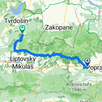
Stredná trasa Vikartovce
A cycling route starting in Svit, Prešov Region, Slovakia.
Overview
About this route
- 14 min
- Duration
- 1.5 km
- Distance
- 138 m
- Ascent
- 95 m
- Descent
- 6.3 km/h
- Avg. speed
- ---
- Max. altitude

Continue with Bikemap
Use, edit, or download this cycling route
You would like to ride Stredná trasa Vikartovce or customize it for your own trip? Here is what you can do with this Bikemap route:
Free features
- Save this route as favorite or in collections
- Copy & plan your own version of this route
- Sync your route with Garmin or Wahoo
Premium features
Free trial for 3 days, or one-time payment. More about Bikemap Premium.
- Navigate this route on iOS & Android
- Export a GPX / KML file of this route
- Create your custom printout (try it for free)
- Download this route for offline navigation
Discover more Premium features.
Get Bikemap PremiumFrom our community
Other popular routes starting in Svit
 Svit - Kolesárky - Vikartovský mlyn
- Distance
- 23.3 km
- Ascent
- 430 m
- Descent
- 272 m
- Location
- Svit, Prešov Region, Slovakia
 Svit-Šuňava-Móryho výhliadka-Svit
- Distance
- 48.6 km
- Ascent
- 473 m
- Descent
- 807 m
- Location
- Svit, Prešov Region, Slovakia
 EBT 2023 1.etapa
- Distance
- 82.1 km
- Ascent
- 1,895 m
- Descent
- 1,850 m
- Location
- Svit, Prešov Region, Slovakia
 Svit - Hágy - Popradské pleso - Lučivná - Svit
- Distance
- 45.6 km
- Ascent
- 1,099 m
- Descent
- 1,096 m
- Location
- Svit, Prešov Region, Slovakia
 Kapitána Nálepku 102 do Mierová 63
- Distance
- 23.8 km
- Ascent
- 302 m
- Descent
- 347 m
- Location
- Svit, Prešov Region, Slovakia
 Teplica okruh
- Distance
- 19.2 km
- Ascent
- 754 m
- Descent
- 757 m
- Location
- Svit, Prešov Region, Slovakia
 Teplicky Trailik
- Distance
- 1.9 km
- Ascent
- 138 m
- Descent
- 30 m
- Location
- Svit, Prešov Region, Slovakia
 Vylet s láskou
- Distance
- 61.2 km
- Ascent
- 1,046 m
- Descent
- 1,073 m
- Location
- Svit, Prešov Region, Slovakia
Open it in the app