

The Long Goose-a-tan
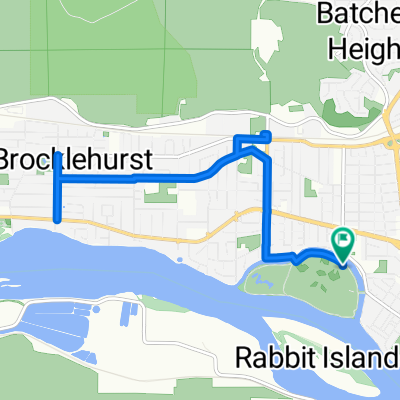
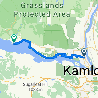
A cycling route starting in Kamloops, British Columbia, Canada.
Overview
About this route
- -:--
- Duration
- 156.1 km
- Distance
- 1,738 m
- Ascent
- 1,736 m
- Descent
- ---
- Avg. speed
- ---
- Max. altitude

Route quality
Waytypes & surfaces along the route
Waytypes
Road
59.3 km
(38 %)
Quiet road
48.4 km
(31 %)
Surfaces
Paved
51.5 km
(33 %)
Unpaved
39 km
(25 %)
Asphalt
32.8 km
(21 %)
Unpaved (undefined)
29.7 km
(19 %)
Continue with Bikemap
Use, edit, or download this cycling route
You would like to ride The Long Goose-a-tan or customize it for your own trip? Here is what you can do with this Bikemap route:
Free features
- Save this route as favorite or in collections
- Copy & plan your own version of this route
- Split it into stages to create a multi-day tour
- Sync your route with Garmin or Wahoo
Premium features
Free trial for 3 days, or one-time payment. More about Bikemap Premium.
- Navigate this route on iOS & Android
- Export a GPX / KML file of this route
- Create your custom printout (try it for free)
- Download this route for offline navigation
Discover more Premium features.
Get Bikemap PremiumFrom our community
Other popular routes starting in Kamloops
 Canadatour 2013
- Distance
- 407.3 km
- Ascent
- 3,187 m
- Descent
- 3,523 m
- Location
- Kamloops, British Columbia, Canada
 Island Parkway to Island Parkway
- Distance
- 11.7 km
- Ascent
- 8 m
- Descent
- 10 m
- Location
- Kamloops, British Columbia, Canada
 The Long Goose-a-tan
- Distance
- 156.1 km
- Ascent
- 1,738 m
- Descent
- 1,736 m
- Location
- Kamloops, British Columbia, Canada
 Tranquille Road to Tranquille Road
- Distance
- 18.4 km
- Ascent
- 30 m
- Descent
- 23 m
- Location
- Kamloops, British Columbia, Canada
 eastshuswap - eastshuswap
- Distance
- 44.2 km
- Ascent
- 177 m
- Descent
- 177 m
- Location
- Kamloops, British Columbia, Canada
 VC9-KamLFort
- Distance
- 100.8 km
- Ascent
- 361 m
- Descent
- 401 m
- Location
- Kamloops, British Columbia, Canada
 Kamloops to Medicine Hat
- Distance
- 1,083.9 km
- Ascent
- 2,183 m
- Descent
- 2,147 m
- Location
- Kamloops, British Columbia, Canada
 33 Albert St, Kamloops to 1525 Island Pky, Kamloops
- Distance
- 0.9 km
- Ascent
- 0 m
- Descent
- 0 m
- Location
- Kamloops, British Columbia, Canada
Open it in the app