

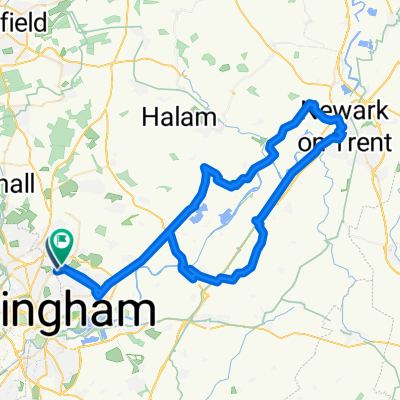
BIKE RIDE WITH ELLIOT
A cycling route starting in Arnold, England, United Kingdom.
Overview
About this route
- -:--
- Duration
- 32.1 km
- Distance
- 80 m
- Ascent
- 121 m
- Descent
- ---
- Avg. speed
- ---
- Max. altitude

Route highlights
Points of interest along the route
Point of interest after 0 km
Point of interest after 2.1 km
Point of interest after 8.8 km
Point of interest after 17.6 km
Point of interest after 23.4 km
Continue with Bikemap
Use, edit, or download this cycling route
You would like to ride BIKE RIDE WITH ELLIOT or customize it for your own trip? Here is what you can do with this Bikemap route:
Free features
- Save this route as favorite or in collections
- Copy & plan your own version of this route
- Sync your route with Garmin or Wahoo
Premium features
Free trial for 3 days, or one-time payment. More about Bikemap Premium.
- Navigate this route on iOS & Android
- Export a GPX / KML file of this route
- Create your custom printout (try it for free)
- Download this route for offline navigation
Discover more Premium features.
Get Bikemap PremiumFrom our community
Other popular routes starting in Arnold
 newark friday 1 nov
- Distance
- 70.6 km
- Ascent
- 249 m
- Descent
- 248 m
- Location
- Arnold, England, United Kingdom
 Good Day Out to Newark
- Distance
- 67.4 km
- Ascent
- 359 m
- Descent
- 355 m
- Location
- Arnold, England, United Kingdom
 Newark castle
- Distance
- 75.9 km
- Ascent
- 285 m
- Descent
- 288 m
- Location
- Arnold, England, United Kingdom
 newark loop
- Distance
- 84 km
- Ascent
- 277 m
- Descent
- 280 m
- Location
- Arnold, England, United Kingdom
 BIKE RIDE WITH ELLIOT
- Distance
- 32.1 km
- Ascent
- 80 m
- Descent
- 121 m
- Location
- Arnold, England, United Kingdom
 2020 Tour
- Distance
- 6,631.6 km
- Ascent
- 3,370 m
- Descent
- 3,370 m
- Location
- Arnold, England, United Kingdom
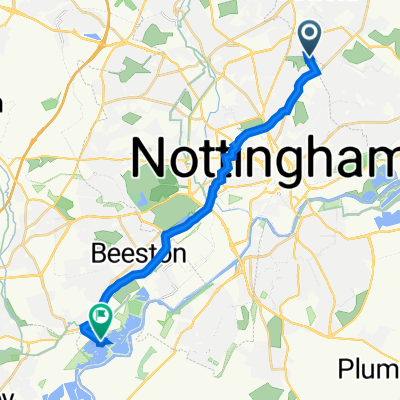 Attenborough Nature Reserve
- Distance
- 15.1 km
- Ascent
- 123 m
- Descent
- 204 m
- Location
- Arnold, England, United Kingdom
 Round trip from Mapperley to River and Canal
- Distance
- 29.3 km
- Ascent
- 582 m
- Descent
- 600 m
- Location
- Arnold, England, United Kingdom
Open it in the app