

Kraichgau - Blick Tour
A cycling route starting in Eppingen, Baden-Wurttemberg, Germany.
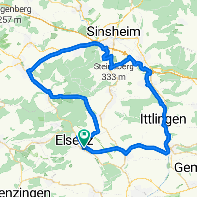
Overview
About this route
- -:--
- Duration
- 44 km
- Distance
- 419 m
- Ascent
- 421 m
- Descent
- ---
- Avg. speed
- ---
- Max. altitude

Route quality
Waytypes & surfaces along the route
Waytypes
Track
25.1 km
(57 %)
Quiet road
9.7 km
(22 %)
Surfaces
Paved
23.3 km
(53 %)
Unpaved
15.9 km
(36 %)
Asphalt
19.8 km
(45 %)
Gravel
9.2 km
(21 %)
Continue with Bikemap
Use, edit, or download this cycling route
You would like to ride Kraichgau - Blick Tour or customize it for your own trip? Here is what you can do with this Bikemap route:
Free features
- Save this route as favorite or in collections
- Copy & plan your own version of this route
- Sync your route with Garmin or Wahoo
Premium features
Free trial for 3 days, or one-time payment. More about Bikemap Premium.
- Navigate this route on iOS & Android
- Export a GPX / KML file of this route
- Create your custom printout (try it for free)
- Download this route for offline navigation
Discover more Premium features.
Get Bikemap PremiumFrom our community
Other popular routes starting in Eppingen
 Route_1 (Eppingen)
- Distance
- 34.9 km
- Ascent
- 155 m
- Descent
- 155 m
- Location
- Eppingen, Baden-Wurttemberg, Germany
 Tour de Stromberg
- Distance
- 63.1 km
- Ascent
- 837 m
- Descent
- 751 m
- Location
- Eppingen, Baden-Wurttemberg, Germany
 von Eppingen zum Neckar durch Heidelberg nach Karlsruhe
- Distance
- 151 km
- Ascent
- 569 m
- Descent
- 654 m
- Location
- Eppingen, Baden-Wurttemberg, Germany
 Elsenztal-Tour im Kraichgau-Stromberg
- Distance
- 38.7 km
- Ascent
- 55 m
- Descent
- 144 m
- Location
- Eppingen, Baden-Wurttemberg, Germany
 De Eppinger Straße, Eppingen a Marktstraße 13, Eppingen
- Distance
- 8.3 km
- Ascent
- 92 m
- Descent
- 91 m
- Location
- Eppingen, Baden-Wurttemberg, Germany
 RR von Eppingen zu den Schönheiten des Kraichgau
- Distance
- 62.6 km
- Ascent
- 598 m
- Descent
- 603 m
- Location
- Eppingen, Baden-Wurttemberg, Germany
 41 km Elsenz-Dühren-Angelbachtal
- Distance
- 41.8 km
- Ascent
- 282 m
- Descent
- 267 m
- Location
- Eppingen, Baden-Wurttemberg, Germany
 einfach..
- Distance
- 28.4 km
- Ascent
- 83 m
- Descent
- 123 m
- Location
- Eppingen, Baden-Wurttemberg, Germany
Open it in the app