

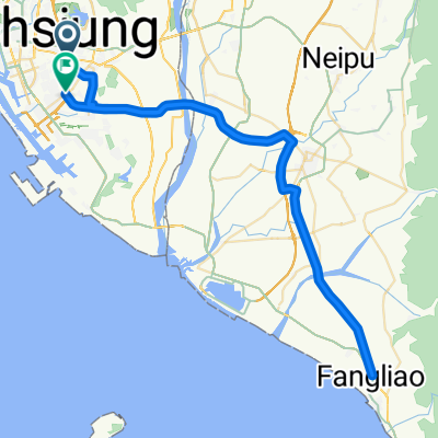
單車路線,東照山咖啡
A cycling route starting in Fongshan District, Taiwan, Taiwan.
Overview
About this route
- 3 h 16 min
- Duration
- 23.6 km
- Distance
- 272 m
- Ascent
- 283 m
- Descent
- 7.2 km/h
- Avg. speed
- ---
- Max. altitude

Route quality
Waytypes & surfaces along the route
Waytypes
Road
11.8 km
(50 %)
Quiet road
7.1 km
(30 %)
Surfaces
Paved
0.9 km
(4 %)
Asphalt
0.9 km
(4 %)
Undefined
22.6 km
(96 %)
Continue with Bikemap
Use, edit, or download this cycling route
You would like to ride 單車路線,東照山咖啡 or customize it for your own trip? Here is what you can do with this Bikemap route:
Free features
- Save this route as favorite or in collections
- Copy & plan your own version of this route
- Sync your route with Garmin or Wahoo
Premium features
Free trial for 3 days, or one-time payment. More about Bikemap Premium.
- Navigate this route on iOS & Android
- Export a GPX / KML file of this route
- Create your custom printout (try it for free)
- Download this route for offline navigation
Discover more Premium features.
Get Bikemap PremiumFrom our community
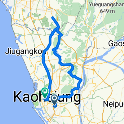
Other popular routes starting in Fongshan District
 仁武至衛武營
- Distance
- 23.2 km
- Ascent
- 673 m
- Descent
- 722 m
- Location
- Fongshan District, Taiwan, Taiwan
 City course
- Distance
- 63.2 km
- Ascent
- 335 m
- Descent
- 347 m
- Location
- Fongshan District, Taiwan, Taiwan
 雙寮‧中寮
雙寮‧中寮- Distance
- 60.8 km
- Ascent
- 637 m
- Descent
- 638 m
- Location
- Fongshan District, Taiwan, Taiwan
 瘋400K試騎路線圖
- Distance
- 205.9 km
- Ascent
- 779 m
- Descent
- 772 m
- Location
- Fongshan District, Taiwan, Taiwan
 LSD 衛武營 - 水底寮 2013-04-21
- Distance
- 93 km
- Ascent
- 83 m
- Descent
- 85 m
- Location
- Fongshan District, Taiwan, Taiwan
 中寮山輕鬆路線50公里腳力鍛鍊
- Distance
- 50.9 km
- Ascent
- 603 m
- Descent
- 594 m
- Location
- Fongshan District, Taiwan, Taiwan
 20180323 澄清湖首圈
- Distance
- 4.3 km
- Ascent
- 38 m
- Descent
- 64 m
- Location
- Fongshan District, Taiwan, Taiwan
 LSD 仁美-關廟
- Distance
- 97.2 km
- Ascent
- 380 m
- Descent
- 376 m
- Location
- Fongshan District, Taiwan, Taiwan
Open it in the app