

Forest ride on Road Bike - Bad Surface
A cycling route starting in Bratislava - Vajnory, Bratislava Region, Slovakia.
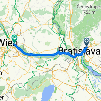
Overview
About this route
- 1 h 40 min
- Duration
- 11.9 km
- Distance
- 276 m
- Ascent
- 275 m
- Descent
- 7.1 km/h
- Avg. speed
- ---
- Max. altitude

Route photos


Route quality
Waytypes & surfaces along the route
Waytypes
Quiet road
9.6 km
(81 %)
Pedestrian area
0.9 km
(8 %)
Surfaces
Paved
8.2 km
(69 %)
Unpaved
0.6 km
(5 %)
Asphalt
8.2 km
(69 %)
Ground
0.6 km
(5 %)
Continue with Bikemap
Use, edit, or download this cycling route
You would like to ride Forest ride on Road Bike - Bad Surface or customize it for your own trip? Here is what you can do with this Bikemap route:
Free features
- Save this route as favorite or in collections
- Copy & plan your own version of this route
- Sync your route with Garmin or Wahoo
Premium features
Free trial for 3 days, or one-time payment. More about Bikemap Premium.
- Navigate this route on iOS & Android
- Export a GPX / KML file of this route
- Create your custom printout (try it for free)
- Download this route for offline navigation
Discover more Premium features.
Get Bikemap PremiumFrom our community
Other popular routes starting in Bratislava - Vajnory
 Forest ride on Road Bike - Bad Surface
- Distance
- 11.9 km
- Ascent
- 276 m
- Descent
- 275 m
- Location
- Bratislava - Vajnory, Bratislava Region, Slovakia
 Jasná
Jasná- Distance
- 311.9 km
- Ascent
- 1,773 m
- Descent
- 732 m
- Location
- Bratislava - Vajnory, Bratislava Region, Slovakia
 BA-Donovaly-Jasná
- Distance
- 309.3 km
- Ascent
- 1,803 m
- Descent
- 780 m
- Location
- Bratislava - Vajnory, Bratislava Region, Slovakia
 Pekná cesta - Biely kríž - Štefánikova mohyla
- Distance
- 46.6 km
- Ascent
- 1,607 m
- Descent
- 1,619 m
- Location
- Bratislava - Vajnory, Bratislava Region, Slovakia
 Pri vinohradoch 9799/269E, Bratislava až Pri starom letisku, Vajnory
- Distance
- 32.5 km
- Ascent
- 60 m
- Descent
- 84 m
- Location
- Bratislava - Vajnory, Bratislava Region, Slovakia
 Nepretržitá jazda Bratislava.
- Distance
- 47.1 km
- Ascent
- 131 m
- Descent
- 132 m
- Location
- Bratislava - Vajnory, Bratislava Region, Slovakia
 7. Bratislava-Vienna
- Distance
- 72.5 km
- Ascent
- 269 m
- Descent
- 233 m
- Location
- Bratislava - Vajnory, Bratislava Region, Slovakia
 Haimburg_Berg_01
- Distance
- 61.9 km
- Ascent
- 151 m
- Descent
- 150 m
- Location
- Bratislava - Vajnory, Bratislava Region, Slovakia
Open it in the app