

Maruoka Cycling
A cycling route starting in Maruoka, Fukui, Japan.
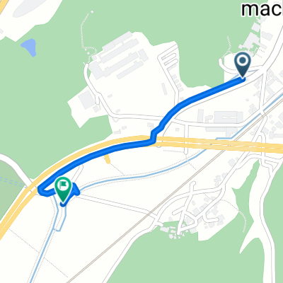
Overview
About this route
- -:--
- Duration
- 19.3 km
- Distance
- 38 m
- Ascent
- 260 m
- Descent
- ---
- Avg. speed
- ---
- Max. altitude

Route quality
Waytypes & surfaces along the route
Waytypes
Cycleway
6.2 km
(32 %)
Road
4.2 km
(22 %)
Surfaces
Paved
7.3 km
(38 %)
Paved (undefined)
6.2 km
(32 %)
Asphalt
1.2 km
(6 %)
Undefined
11.9 km
(62 %)
Continue with Bikemap
Use, edit, or download this cycling route
You would like to ride Maruoka Cycling or customize it for your own trip? Here is what you can do with this Bikemap route:
Free features
- Save this route as favorite or in collections
- Copy & plan your own version of this route
- Sync your route with Garmin or Wahoo
Premium features
Free trial for 3 days, or one-time payment. More about Bikemap Premium.
- Navigate this route on iOS & Android
- Export a GPX / KML file of this route
- Create your custom printout (try it for free)
- Download this route for offline navigation
Discover more Premium features.
Get Bikemap PremiumFrom our community
Other popular routes starting in Maruoka
 Japone 7
- Distance
- 252.7 km
- Ascent
- 5,535 m
- Descent
- 4,674 m
- Location
- Maruoka, Fukui, Japan
 7月5日昼
7月5日昼- Distance
- 23.2 km
- Ascent
- 1,784 m
- Descent
- 1,812 m
- Location
- Maruoka, Fukui, Japan
 Country Club
- Distance
- 4.6 km
- Ascent
- 117 m
- Descent
- 55 m
- Location
- Maruoka, Fukui, Japan
 TEMPLE EIHEI-JI - MIHAMA
- Distance
- 89.3 km
- Ascent
- 658 m
- Descent
- 680 m
- Location
- Maruoka, Fukui, Japan
 丸岡サイクリングコース
- Distance
- 26 km
- Ascent
- 388 m
- Descent
- 387 m
- Location
- Maruoka, Fukui, Japan
 永平寺福井自転車道
- Distance
- 26.2 km
- Ascent
- 18 m
- Descent
- 56 m
- Location
- Maruoka, Fukui, Japan
 丸岡町長崎9-8-2, 坂井市 to 丸岡町高柳2-13-18, 坂井市
- Distance
- 3.1 km
- Ascent
- 6 m
- Descent
- 3 m
- Location
- Maruoka, Fukui, Japan
 Daishojishitayashikimachi, Kaga to Kumasakamachi, Kaga
- Distance
- 1.2 km
- Ascent
- 13 m
- Descent
- 3 m
- Location
- Maruoka, Fukui, Japan
Open it in the app