

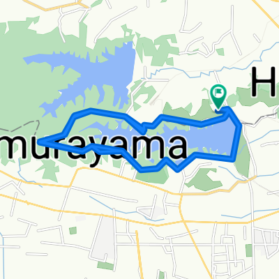
Ruta tranquila en Koganei-Shi
A cycling route starting in Higashimurayama, Tokyo, Japan.
Overview
About this route
- 26 min
- Duration
- 6.3 km
- Distance
- 0 m
- Ascent
- 13 m
- Descent
- 14.4 km/h
- Avg. speed
- ---
- Max. altitude

Route quality
Waytypes & surfaces along the route
Waytypes
Road
3.4 km
(54 %)
Quiet road
2.1 km
(33 %)
Surfaces
Paved
0.6 km
(10 %)
Asphalt
0.4 km
(7 %)
Paved (undefined)
0.2 km
(3 %)
Undefined
5.6 km
(90 %)
Continue with Bikemap
Use, edit, or download this cycling route
You would like to ride Ruta tranquila en Koganei-Shi or customize it for your own trip? Here is what you can do with this Bikemap route:
Free features
- Save this route as favorite or in collections
- Copy & plan your own version of this route
- Sync your route with Garmin or Wahoo
Premium features
Free trial for 3 days, or one-time payment. More about Bikemap Premium.
- Navigate this route on iOS & Android
- Export a GPX / KML file of this route
- Create your custom printout (try it for free)
- Download this route for offline navigation
Discover more Premium features.
Get Bikemap PremiumFrom our community
Other popular routes starting in Higashimurayama
 Tamako
- Distance
- 37.6 km
- Ascent
- 209 m
- Descent
- 209 m
- Location
- Higashimurayama, Tokyo, Japan
 多摩湖からの帰り路
- Distance
- 14.6 km
- Ascent
- 84 m
- Descent
- 146 m
- Location
- Higashimurayama, Tokyo, Japan
 Start to Nikko
- Distance
- 140.2 km
- Ascent
- 552 m
- Descent
- 96 m
- Location
- Higashimurayama, Tokyo, Japan
 3丁目 2, 小平市 まで7丁目 1, 小平市
- Distance
- 0.6 km
- Ascent
- 4 m
- Descent
- 0 m
- Location
- Higashimurayama, Tokyo, Japan
 Matsugaoka Chuo-dori Avenue, Tokorozawa to Tamako, Higashiyamato
- Distance
- 24.8 km
- Ascent
- 71 m
- Descent
- 37 m
- Location
- Higashimurayama, Tokyo, Japan
 3丁目, 東大和市 まで2丁目 12, 川口市
- Distance
- 34.6 km
- Ascent
- 66 m
- Descent
- 145 m
- Location
- Higashimurayama, Tokyo, Japan
 Ruta tranquila en Koganei-Shi
- Distance
- 6.3 km
- Ascent
- 0 m
- Descent
- 13 m
- Location
- Higashimurayama, Tokyo, Japan
 to Iruma Bridge
- Distance
- 23.6 km
- Ascent
- 97 m
- Descent
- 173 m
- Location
- Higashimurayama, Tokyo, Japan
Open it in the app