

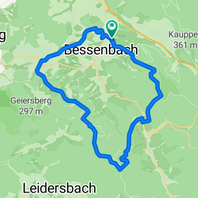
Waldaschaff- Rohrbrunn- Marktheidenfeld
A cycling route starting in Waldaschaff, Bavaria, Germany.
Overview
About this route
- -:--
- Duration
- 80.1 km
- Distance
- 837 m
- Ascent
- 837 m
- Descent
- ---
- Avg. speed
- ---
- Max. altitude
Continue with Bikemap
Use, edit, or download this cycling route
You would like to ride Waldaschaff- Rohrbrunn- Marktheidenfeld or customize it for your own trip? Here is what you can do with this Bikemap route:
Free features
- Save this route as favorite or in collections
- Copy & plan your own version of this route
- Split it into stages to create a multi-day tour
- Sync your route with Garmin or Wahoo
Premium features
Free trial for 3 days, or one-time payment. More about Bikemap Premium.
- Navigate this route on iOS & Android
- Export a GPX / KML file of this route
- Create your custom printout (try it for free)
- Download this route for offline navigation
Discover more Premium features.
Get Bikemap PremiumFrom our community
Other popular routes starting in Waldaschaff
 Waldaschaff - Echterspfahl
- Distance
- 14.1 km
- Ascent
- 488 m
- Descent
- 197 m
- Location
- Waldaschaff, Bavaria, Germany
 Waldaschaff- Rohrbrunn- Marktheidenfeld
- Distance
- 80.1 km
- Ascent
- 837 m
- Descent
- 837 m
- Location
- Waldaschaff, Bavaria, Germany
 explore south-east aschaffenbörg
- Distance
- 51.1 km
- Ascent
- 302 m
- Descent
- 302 m
- Location
- Waldaschaff, Bavaria, Germany
 weibersbrunn rothenbuch
- Distance
- 26 km
- Ascent
- 558 m
- Descent
- 560 m
- Location
- Waldaschaff, Bavaria, Germany
 down & up A3 in Waldaschaff
- Distance
- 9.8 km
- Ascent
- 234 m
- Descent
- 235 m
- Location
- Waldaschaff, Bavaria, Germany
 "Die Wand"
- Distance
- 12.7 km
- Ascent
- 283 m
- Descent
- 282 m
- Location
- Waldaschaff, Bavaria, Germany
 Kreuzbergrunde 1
- Distance
- 11.1 km
- Ascent
- 140 m
- Descent
- 149 m
- Location
- Waldaschaff, Bavaria, Germany
 Keilberg - Hohe Warte
- Distance
- 24.5 km
- Ascent
- 404 m
- Descent
- 404 m
- Location
- Waldaschaff, Bavaria, Germany
Open it in the app