

Rund ums Geiger Köpfle
A cycling route starting in Ortenberg, Baden-Wurttemberg, Germany.
Overview
About this route
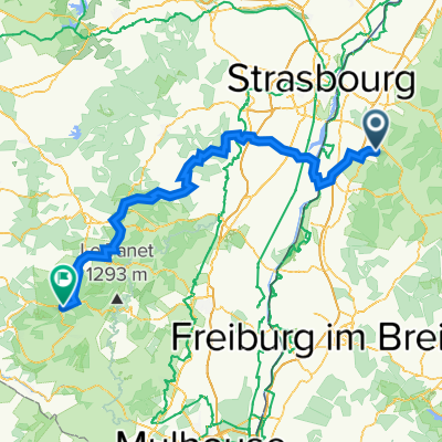
From Ortenberg to Rammersweiher, then to Durbach and along the Wine Route to Oberkirch. From the roundabout at the B 28 towards Nussbach, at the junction Müllen to Zusenhofen. Continuing to Appenweiher, Windschläg, Bühl, Offenburg. From Offenburg on cycle paths back to Ortenberg, the starting point.
- -:--
- Duration
- 41.3 km
- Distance
- 235 m
- Ascent
- 232 m
- Descent
- ---
- Avg. speed
- ---
- Max. altitude

Route quality
Waytypes & surfaces along the route
Waytypes
Road
11.6 km
(28 %)
Quiet road
9.5 km
(23 %)
Surfaces
Paved
33.1 km
(80 %)
Unpaved
0.8 km
(2 %)
Asphalt
28.1 km
(68 %)
Paved (undefined)
4.5 km
(11 %)
Continue with Bikemap
Use, edit, or download this cycling route
You would like to ride Rund ums Geiger Köpfle or customize it for your own trip? Here is what you can do with this Bikemap route:
Free features
- Save this route as favorite or in collections
- Copy & plan your own version of this route
- Sync your route with Garmin or Wahoo
Premium features
Free trial for 3 days, or one-time payment. More about Bikemap Premium.
- Navigate this route on iOS & Android
- Export a GPX / KML file of this route
- Create your custom printout (try it for free)
- Download this route for offline navigation
Discover more Premium features.
Get Bikemap PremiumFrom our community
Other popular routes starting in Ortenberg
 Sattlerweg 2, Offenburg nach Blumenstraße 4A, Hohberg
- Distance
- 66.8 km
- Ascent
- 1,157 m
- Descent
- 1,150 m
- Location
- Ortenberg, Baden-Wurttemberg, Germany
 horn
horn- Distance
- 4.3 km
- Ascent
- 468 m
- Descent
- 93 m
- Location
- Ortenberg, Baden-Wurttemberg, Germany
 Schönberg ( einfach )
- Distance
- 49.2 km
- Ascent
- 309 m
- Descent
- 308 m
- Location
- Ortenberg, Baden-Wurttemberg, Germany
 Elsass 2021
- Distance
- 297.1 km
- Ascent
- 434 m
- Descent
- 517 m
- Location
- Ortenberg, Baden-Wurttemberg, Germany
 Deutschland rundum
- Distance
- 350.7 km
- Ascent
- 372 m
- Descent
- 180 m
- Location
- Ortenberg, Baden-Wurttemberg, Germany
 Rund ums Geiger Köpfle
- Distance
- 41.3 km
- Ascent
- 235 m
- Descent
- 232 m
- Location
- Ortenberg, Baden-Wurttemberg, Germany
 Route 1 Elsaßtour (Roller)
- Distance
- 156.5 km
- Ascent
- 1,776 m
- Descent
- 1,288 m
- Location
- Ortenberg, Baden-Wurttemberg, Germany
 Zell-Weierbach - Wetterfähnle - Wolfsgrube - Zeller-Brunnen - Brandeck - Fritscheneck - Hohes-Horn - Albersbach - Riedle- Zell-Weierbach
- Distance
- 15.7 km
- Ascent
- 698 m
- Descent
- 698 m
- Location
- Ortenberg, Baden-Wurttemberg, Germany
Open it in the app