

?(¿…°? do ?‘ …?
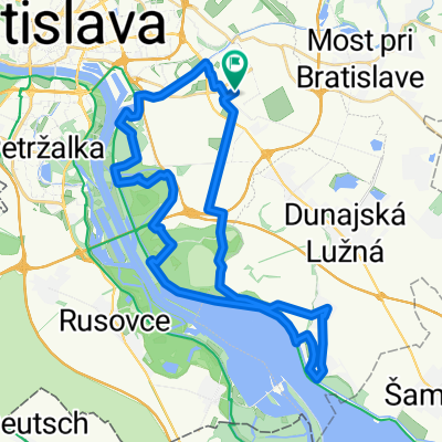
A cycling route starting in Dunajská Lužná, Bratislava Region, Slovakia.
Overview
About this route
- 28 min
- Duration
- 7.5 km
- Distance
- 26 m
- Ascent
- 26 m
- Descent
- 16.1 km/h
- Avg. speed
- ---
- Max. altitude
Route quality
Waytypes & surfaces along the route
Waytypes
Cycleway
4.1 km
(55 %)
Quiet road
1.5 km
(20 %)
Surfaces
Paved
6.3 km
(84 %)
Asphalt
6.3 km
(84 %)
Undefined
1.2 km
(16 %)
Continue with Bikemap
Use, edit, or download this cycling route
You would like to ride ?(¿…°? do ?‘ …? or customize it for your own trip? Here is what you can do with this Bikemap route:
Free features
- Save this route as favorite or in collections
- Copy & plan your own version of this route
- Sync your route with Garmin or Wahoo
Premium features
Free trial for 3 days, or one-time payment. More about Bikemap Premium.
- Navigate this route on iOS & Android
- Export a GPX / KML file of this route
- Create your custom printout (try it for free)
- Download this route for offline navigation
Discover more Premium features.
Get Bikemap PremiumFrom our community
Other popular routes starting in Dunajská Lužná
 2013-08-16: Bratislava - Pozba (Podhájska)
- Distance
- 114.4 km
- Ascent
- 57 m
- Descent
- 35 m
- Location
- Dunajská Lužná, Bratislava Region, Slovakia
 Po Dunajských luhoch a hrádzi Dunaja
- Distance
- 42.1 km
- Ascent
- 28 m
- Descent
- 28 m
- Location
- Dunajská Lužná, Bratislava Region, Slovakia
 Rovinata casovka okolo Maleho Dunaja
- Distance
- 49.4 km
- Ascent
- 8 m
- Descent
- 9 m
- Location
- Dunajská Lužná, Bratislava Region, Slovakia
 Tour de Bałkany 2017 dzień 2
- Distance
- 167.9 km
- Ascent
- 523 m
- Descent
- 541 m
- Location
- Dunajská Lužná, Bratislava Region, Slovakia
 Nedeľný bajk Dunajska Luzna - Petrzalka
- Distance
- 17.5 km
- Ascent
- 29 m
- Descent
- 23 m
- Location
- Dunajská Lužná, Bratislava Region, Slovakia
 au moja riť
- Distance
- 56.7 km
- Ascent
- 424 m
- Descent
- 422 m
- Location
- Dunajská Lužná, Bratislava Region, Slovakia
 PodBisk - Rovinka - Dunajska Luzna - Hamuliakovo - po hradzi aj lesom popri Dunaji - PodBisk
- Distance
- 36.1 km
- Ascent
- 130 m
- Descent
- 131 m
- Location
- Dunajská Lužná, Bratislava Region, Slovakia
 Szent-Márton út
- Distance
- 61.8 km
- Ascent
- 5 m
- Descent
- 22 m
- Location
- Dunajská Lužná, Bratislava Region, Slovakia
Open it in the app