
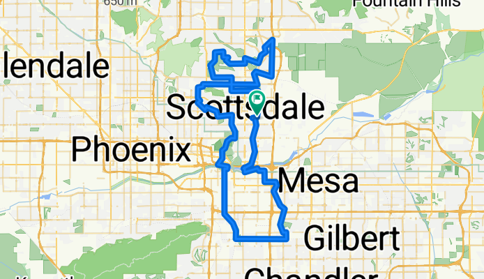
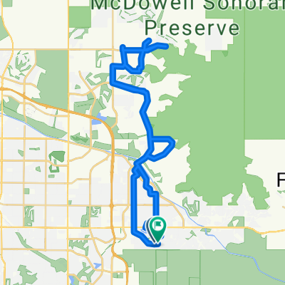
Ultimate Warrior
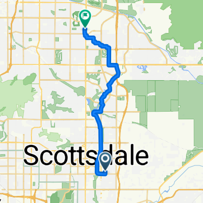
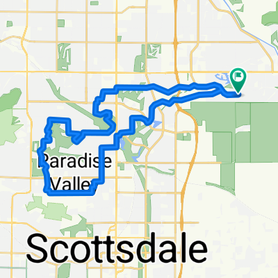
A cycling route starting in Scottsdale, Arizona, United States.
Overview
About this route
- -:--
- Duration
- 97.2 km
- Distance
- 199 m
- Ascent
- 199 m
- Descent
- ---
- Avg. speed
- ---
- Max. altitude

Route quality
Waytypes & surfaces along the route
Waytypes
Cycleway
43.7 km
(45 %)
Road
18.5 km
(19 %)
Surfaces
Paved
88.5 km
(91 %)
Unpaved
1.9 km
(2 %)
Asphalt
43.7 km
(45 %)
Concrete
42.8 km
(44 %)
Continue with Bikemap
Use, edit, or download this cycling route
You would like to ride Ultimate Warrior or customize it for your own trip? Here is what you can do with this Bikemap route:
Free features
- Save this route as favorite or in collections
- Copy & plan your own version of this route
- Split it into stages to create a multi-day tour
- Sync your route with Garmin or Wahoo
Premium features
Free trial for 3 days, or one-time payment. More about Bikemap Premium.
- Navigate this route on iOS & Android
- Export a GPX / KML file of this route
- Create your custom printout (try it for free)
- Download this route for offline navigation
Discover more Premium features.
Get Bikemap PremiumFrom our community
Other popular routes starting in Scottsdale
 E Solano Dr, Scottsdale to E Solano Dr, Scottsdale
- Distance
- 27.5 km
- Ascent
- 48 m
- Descent
- 47 m
- Location
- Scottsdale, Arizona, United States
 11796–11798 E Stonegate Cir, Scottsdale to 16300 McDowell Mountain Park Dr, Scottsdale
- Distance
- 28.2 km
- Ascent
- 340 m
- Descent
- 180 m
- Location
- Scottsdale, Arizona, United States
 Mountain View to Pinnacle Peak in Scottsdale
- Distance
- 52.9 km
- Ascent
- 470 m
- Descent
- 467 m
- Location
- Scottsdale, Arizona, United States
 N Granite Reef Rd, Scottsdale to N Granite Reef Rd, Scottsdale
- Distance
- 77.7 km
- Ascent
- 429 m
- Descent
- 426 m
- Location
- Scottsdale, Arizona, United States
 Scottsdale Grayhawk Road Ride
- Distance
- 67.9 km
- Ascent
- 562 m
- Descent
- 561 m
- Location
- Scottsdale, Arizona, United States
 Scottsdale Ranch to Mummy Mountain Loop
- Distance
- 41.9 km
- Ascent
- 197 m
- Descent
- 197 m
- Location
- Scottsdale, Arizona, United States
 N 82nd St, Scottsdale to N Scottsdale Rd, Phoenix
- Distance
- 22.2 km
- Ascent
- 84 m
- Descent
- 22 m
- Location
- Scottsdale, Arizona, United States
 East San Salvador Drive to East San Salvador Drive
- Distance
- 37.8 km
- Ascent
- 151 m
- Descent
- 127 m
- Location
- Scottsdale, Arizona, United States
Open it in the app