

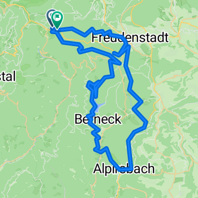
Radtour 2020 Tag 3 - Baiersbronn - Plittersdorf über Sasbachwalden
A cycling route starting in Baiersbronn, Baden-Wurttemberg, Germany.
Overview
About this route
- -:--
- Duration
- 80.1 km
- Distance
- 548 m
- Ascent
- 1,016 m
- Descent
- ---
- Avg. speed
- ---
- Max. altitude

Route quality
Waytypes & surfaces along the route
Waytypes
Track
31.2 km
(39 %)
Quiet road
17.6 km
(22 %)
Surfaces
Paved
53.7 km
(67 %)
Unpaved
20.8 km
(26 %)
Asphalt
52.1 km
(65 %)
Gravel
10.4 km
(13 %)
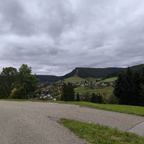
Route highlights
Points of interest along the route
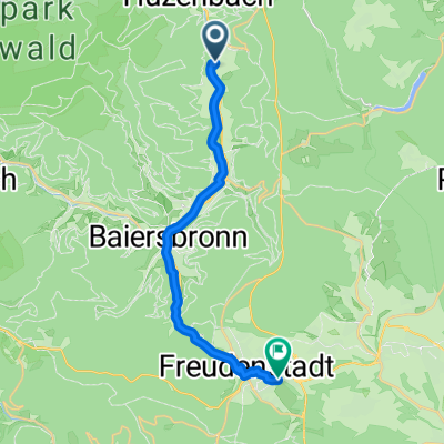
Point of interest after 33.3 km
Continue with Bikemap
Use, edit, or download this cycling route
You would like to ride Radtour 2020 Tag 3 - Baiersbronn - Plittersdorf über Sasbachwalden or customize it for your own trip? Here is what you can do with this Bikemap route:
Free features
- Save this route as favorite or in collections
- Copy & plan your own version of this route
- Split it into stages to create a multi-day tour
- Sync your route with Garmin or Wahoo
Premium features
Free trial for 3 days, or one-time payment. More about Bikemap Premium.
- Navigate this route on iOS & Android
- Export a GPX / KML file of this route
- Create your custom printout (try it for free)
- Download this route for offline navigation
Discover more Premium features.
Get Bikemap PremiumFrom our community
Other popular routes starting in Baiersbronn
 Radtour 2020 Tag 3 - Baiersbronn - Plittersdorf über Sasbachwalden
- Distance
- 80.1 km
- Ascent
- 548 m
- Descent
- 1,016 m
- Location
- Baiersbronn, Baden-Wurttemberg, Germany
 Tour de Murg *flussabwärts* bis Forbach
- Distance
- 29.9 km
- Ascent
- 75 m
- Descent
- 382 m
- Location
- Baiersbronn, Baden-Wurttemberg, Germany
 Baiersbronn - Renchtalhütte - Kniebis - Baiersbronn
- Distance
- 39.5 km
- Ascent
- 827 m
- Descent
- 826 m
- Location
- Baiersbronn, Baden-Wurttemberg, Germany
 Route in Freudenstadt
- Distance
- 65.8 km
- Ascent
- 2,258 m
- Descent
- 2,297 m
- Location
- Baiersbronn, Baden-Wurttemberg, Germany
 250811 Landesgartenschau
- Distance
- 17.1 km
- Ascent
- 385 m
- Descent
- 216 m
- Location
- Baiersbronn, Baden-Wurttemberg, Germany
 Rundfahrt Baiersbronn T2
- Distance
- 101.8 km
- Ascent
- 2,034 m
- Descent
- 2,014 m
- Location
- Baiersbronn, Baden-Wurttemberg, Germany
 Rinkenteich nach Rappenberghalde 55/4
- Distance
- 92.6 km
- Ascent
- 963 m
- Descent
- 1,387 m
- Location
- Baiersbronn, Baden-Wurttemberg, Germany
 Hotel Engel Obertal Waterval
- Distance
- 36.6 km
- Ascent
- 902 m
- Descent
- 903 m
- Location
- Baiersbronn, Baden-Wurttemberg, Germany
Open it in the app