

Bester Weg SAP ROT - Mannheim
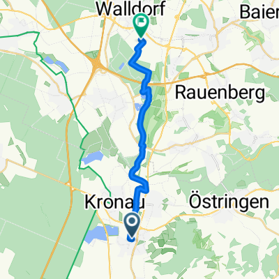
A cycling route starting in Kronau, Baden-Wurttemberg, Germany.
Overview
About this route
Here is a shorter alternative to Route 594282 (see http://www.bikemap.net/route/594282), which bypasses Schwetzingen and runs mostly on well-maintained forest and field paths. The paths are largely asphalted, with some smaller sections covered in gravel. Coming from SAP, you ride almost exclusively on forest or service roads up to Rhenania-Straße; only two or three times do you need to cross a road or follow the road for about two hundred meters. The only drawback is the railway crossing in the Hockenheim forest on the Hockenheim-Oftersheim train line. If the barrier is down, you must ring the call box at the crossing to have it opened. There are two slightly shorter routes (36 and 32 kilometers), but these routes are already very road-heavy, especially the shorter one.
The route is also well suited as a relaxing ride for touring cyclists who enjoy the fresh morning air in the forest or want to visit the wild boars in the Hardtwald.
- -:--
- Duration
- 37.5 km
- Distance
- 59 m
- Ascent
- 70 m
- Descent
- ---
- Avg. speed
- ---
- Max. altitude
Route quality
Waytypes & surfaces along the route
Waytypes
Track
21 km
(56 %)
Quiet road
4.9 km
(13 %)
Surfaces
Paved
31.8 km
(85 %)
Unpaved
1.9 km
(5 %)
Asphalt
29.2 km
(78 %)
Paved (undefined)
2.2 km
(6 %)
Continue with Bikemap
Use, edit, or download this cycling route
You would like to ride Bester Weg SAP ROT - Mannheim or customize it for your own trip? Here is what you can do with this Bikemap route:
Free features
- Save this route as favorite or in collections
- Copy & plan your own version of this route
- Sync your route with Garmin or Wahoo
Premium features
Free trial for 3 days, or one-time payment. More about Bikemap Premium.
- Navigate this route on iOS & Android
- Export a GPX / KML file of this route
- Create your custom printout (try it for free)
- Download this route for offline navigation
Discover more Premium features.
Get Bikemap PremiumFrom our community
Other popular routes starting in Kronau
 BW-Rundfahrt
- Distance
- 801 km
- Ascent
- 1,081 m
- Descent
- 1,082 m
- Location
- Kronau, Baden-Wurttemberg, Germany
 Kraichgau-Triathlon (2. Runde)
- Distance
- 50.8 km
- Ascent
- 746 m
- Descent
- 740 m
- Location
- Kronau, Baden-Wurttemberg, Germany
 In der Gänsweide, Bad Schönborn to Industriestraße, Walldorf
- Distance
- 13.1 km
- Ascent
- 24 m
- Descent
- 30 m
- Location
- Kronau, Baden-Wurttemberg, Germany
 Kraichgau - BS, Sinsheim Burg
- Distance
- 47.5 km
- Ascent
- 503 m
- Descent
- 500 m
- Location
- Kronau, Baden-Wurttemberg, Germany
 Vorderodenwald
- Distance
- 82.6 km
- Ascent
- 1,010 m
- Descent
- 964 m
- Location
- Kronau, Baden-Wurttemberg, Germany
 SAP ROT - MA Entspannungsroute
- Distance
- 39 km
- Ascent
- 79 m
- Descent
- 90 m
- Location
- Kronau, Baden-Wurttemberg, Germany
 SAP ROT - Wiesloch durch Wald und Feld (flach)
- Distance
- 8.4 km
- Ascent
- 46 m
- Descent
- 26 m
- Location
- Kronau, Baden-Wurttemberg, Germany
 Bester Weg SAP ROT - Mannheim
- Distance
- 37.5 km
- Ascent
- 59 m
- Descent
- 70 m
- Location
- Kronau, Baden-Wurttemberg, Germany
Open it in the app