

Ettlingen-Bad-Herrenalb-Weithäusle-Dobel-Ittersbach-Ettlingen
A cycling route starting in Ettlingen, Baden-Wurttemberg, Germany.
Overview
About this route
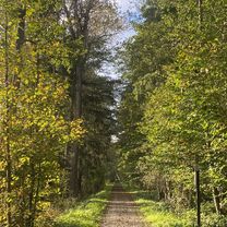
The route starts at the swimming pool in Ettlingen. Right at the beginning, there's a busy ascent of about 3 km to conquer towards Spessart.
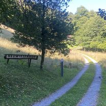
We continue through Schöllbronn and Völersbach along the heights road towards Freiolsheim. From Freiolsheim, we head towards the pilgrimage site of Moosbronn with its beautiful baroque church. We ride on to Bernbach and enjoy a very nice descent down to Bad Herrenalb. At the intersection at the entrance to the village, we keep to the right, pass by the spa park, and arrive at a roundabout in the town center. Here we turn left towards Dobel. However, after about 140 m, we turn right again into the Gaistal. Continuation follows!
- -:--
- Duration
- 62.4 km
- Distance
- 1,355 m
- Ascent
- 1,232 m
- Descent
- ---
- Avg. speed
- 830 m
- Max. altitude
Route quality
Waytypes & surfaces along the route
Waytypes
Road
21.2 km
(34 %)
Track
11.2 km
(18 %)
Surfaces
Paved
54.9 km
(88 %)
Unpaved
4.4 km
(7 %)
Asphalt
54.9 km
(88 %)
Gravel
2.5 km
(4 %)
Continue with Bikemap
Use, edit, or download this cycling route
You would like to ride Ettlingen-Bad-Herrenalb-Weithäusle-Dobel-Ittersbach-Ettlingen or customize it for your own trip? Here is what you can do with this Bikemap route:
Free features
- Save this route as favorite or in collections
- Copy & plan your own version of this route
- Sync your route with Garmin or Wahoo
Premium features
Free trial for 3 days, or one-time payment. More about Bikemap Premium.
- Navigate this route on iOS & Android
- Export a GPX / KML file of this route
- Create your custom printout (try it for free)
- Download this route for offline navigation
Discover more Premium features.
Get Bikemap PremiumFrom our community
Other popular routes starting in Ettlingen
 Neuroder Straße, Waldbronn nach Neuroder Straße, Waldbronn
- Distance
- 27.2 km
- Ascent
- 446 m
- Descent
- 444 m
- Location
- Ettlingen, Baden-Wurttemberg, Germany
 Neuroder Straße, Waldbronn nach Neuroder Straße, Waldbronn
- Distance
- 48.9 km
- Ascent
- 834 m
- Descent
- 834 m
- Location
- Ettlingen, Baden-Wurttemberg, Germany
 Neuroder Straße, Waldbronn nach Annexe du Rhin, Seltz
- Distance
- 46.3 km
- Ascent
- 93 m
- Descent
- 237 m
- Location
- Ettlingen, Baden-Wurttemberg, Germany
 Neuroder Straße, Waldbronn nach Neuroder Straße, Waldbronn
- Distance
- 68.1 km
- Ascent
- 1,311 m
- Descent
- 1,310 m
- Location
- Ettlingen, Baden-Wurttemberg, Germany
 Ettlingen-mahlberg-wattkopf
- Distance
- 48.4 km
- Ascent
- 865 m
- Descent
- 861 m
- Location
- Ettlingen, Baden-Wurttemberg, Germany
 Kleine Moosalbtalrunde
- Distance
- 25.8 km
- Ascent
- 444 m
- Descent
- 451 m
- Location
- Ettlingen, Baden-Wurttemberg, Germany
 Ettlingen-Bad-Herrenalb-Weithäusle-Dobel-Ittersbach-Ettlingen
- Distance
- 62.4 km
- Ascent
- 1,355 m
- Descent
- 1,232 m
- Location
- Ettlingen, Baden-Wurttemberg, Germany
 Ettlingen-Weingarten-PBurg
- Distance
- 49.9 km
- Ascent
- 170 m
- Descent
- 253 m
- Location
- Ettlingen, Baden-Wurttemberg, Germany
Open it in the app