
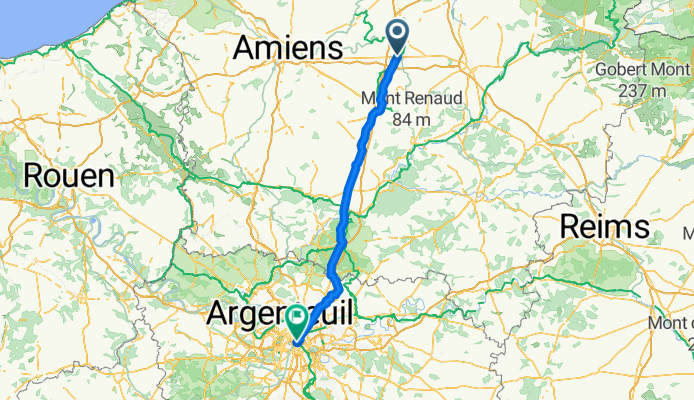
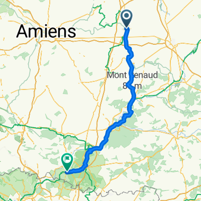
siste 2 etappene av turen
A cycling route starting in Péronne, Hauts-de-France, France.
Overview
About this route
- -:--
- Duration
- 134 km
- Distance
- 309 m
- Ascent
- 343 m
- Descent
- ---
- Avg. speed
- ---
- Max. altitude
Continue with Bikemap
Use, edit, or download this cycling route
You would like to ride siste 2 etappene av turen or customize it for your own trip? Here is what you can do with this Bikemap route:
Free features
- Save this route as favorite or in collections
- Copy & plan your own version of this route
- Split it into stages to create a multi-day tour
- Sync your route with Garmin or Wahoo
Premium features
Free trial for 3 days, or one-time payment. More about Bikemap Premium.
- Navigate this route on iOS & Android
- Export a GPX / KML file of this route
- Create your custom printout (try it for free)
- Download this route for offline navigation
Discover more Premium features.
Get Bikemap PremiumFrom our community
Other popular routes starting in Péronne
 Day 38 Peronne - Champs Elysees
- Distance
- 137.9 km
- Ascent
- 331 m
- Descent
- 345 m
- Location
- Péronne, Hauts-de-France, France
 Untitled route
- Distance
- 44.3 km
- Ascent
- 313 m
- Descent
- 314 m
- Location
- Péronne, Hauts-de-France, France
 J002 - 1er Juin - Péronne to Clermont (ok)
- Distance
- 83.9 km
- Ascent
- 240 m
- Descent
- 200 m
- Location
- Péronne, Hauts-de-France, France
 Route de Paris, Péronne to Rue de la Vallée 37-39, Péronne
- Distance
- 20.6 km
- Ascent
- 72 m
- Descent
- 131 m
- Location
- Péronne, Hauts-de-France, France
 siste 2 etappene av turen
- Distance
- 134 km
- Ascent
- 309 m
- Descent
- 343 m
- Location
- Péronne, Hauts-de-France, France
 CVF05- Saint Quentin-Laon - Via Francigena cycling route
- Distance
- 87.7 km
- Ascent
- 411 m
- Descent
- 301 m
- Location
- Péronne, Hauts-de-France, France
 fr9-peronne_saint quentin
- Distance
- 34 km
- Ascent
- 203 m
- Descent
- 145 m
- Location
- Péronne, Hauts-de-France, France
 LILLE PARIS J2 - Bapaume - Lacroix-Saint-Ouen
- Distance
- 120.6 km
- Ascent
- 536 m
- Descent
- 530 m
- Location
- Péronne, Hauts-de-France, France
Open it in the app