

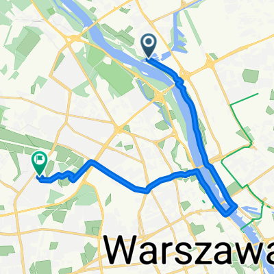
Tarchomin - Park Praski
A cycling route starting in Białołeka, Masovian Voivodeship, Poland.
Overview
About this route
- -:--
- Duration
- 22.8 km
- Distance
- 64 m
- Ascent
- 62 m
- Descent
- ---
- Avg. speed
- ---
- Max. altitude

Route photos

Route quality
Waytypes & surfaces along the route
Waytypes
Path
9.8 km
(43 %)
Cycleway
8.7 km
(38 %)
Surfaces
Paved
16.2 km
(71 %)
Unpaved
4.1 km
(18 %)
Asphalt
15.1 km
(66 %)
Gravel
3.7 km
(16 %)
Continue with Bikemap
Use, edit, or download this cycling route
You would like to ride Tarchomin - Park Praski or customize it for your own trip? Here is what you can do with this Bikemap route:
Free features
- Save this route as favorite or in collections
- Copy & plan your own version of this route
- Sync your route with Garmin or Wahoo
Premium features
Free trial for 3 days, or one-time payment. More about Bikemap Premium.
- Navigate this route on iOS & Android
- Export a GPX / KML file of this route
- Create your custom printout (try it for free)
- Download this route for offline navigation
Discover more Premium features.
Get Bikemap PremiumFrom our community
Other popular routes starting in Białołeka
 Zarzecze do Mieczysława Wolfkego
- Distance
- 16.6 km
- Ascent
- 100 m
- Descent
- 101 m
- Location
- Białołeka, Masovian Voivodeship, Poland
 Waw-Dru
- Distance
- 374.5 km
- Ascent
- 225 m
- Descent
- 220 m
- Location
- Białołeka, Masovian Voivodeship, Poland
 Szklarniowa 23, Warszawa do Szklarniowa 23, Warszawa
- Distance
- 35.9 km
- Ascent
- 117 m
- Descent
- 117 m
- Location
- Białołeka, Masovian Voivodeship, Poland
 Aluzyjna 33F, Białołęka do Aluzyjna 33B–33e, Białołęka
- Distance
- 16.5 km
- Ascent
- 41 m
- Descent
- 42 m
- Location
- Białołeka, Masovian Voivodeship, Poland
 TarchominFabr
- Distance
- 5.7 km
- Ascent
- 5 m
- Descent
- 4 m
- Location
- Białołeka, Masovian Voivodeship, Poland
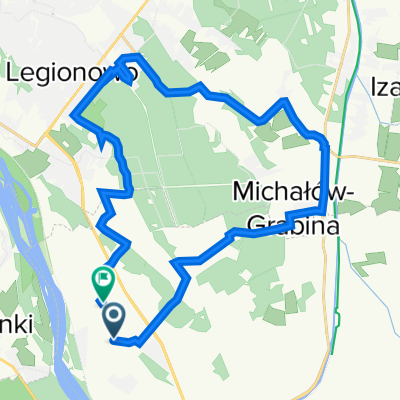
 Nad Zegrze i jeszcze dalej
- Distance
- 64.3 km
- Ascent
- 127 m
- Descent
- 125 m
- Location
- Białołeka, Masovian Voivodeship, Poland
 J Mehoffera 66A, Warszawa do Czorsztyńska 1, Warszawa
- Distance
- 14.1 km
- Ascent
- 68 m
- Descent
- 42 m
- Location
- Białołeka, Masovian Voivodeship, Poland
 Strumykowa, Białołęka do Tłuchowska 16, Białołęka
- Distance
- 27.5 km
- Ascent
- 210 m
- Descent
- 199 m
- Location
- Białołeka, Masovian Voivodeship, Poland
Open it in the app