

Kalkriese-Gut Arentshorst-Venner Moor-Kalkriese
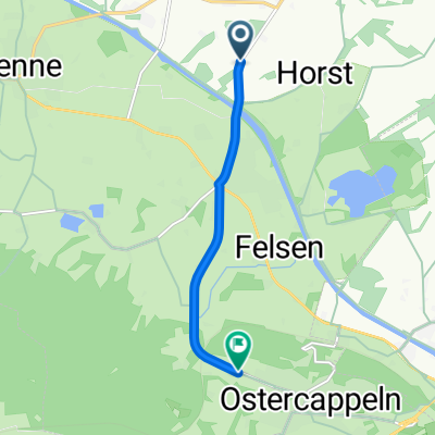
A cycling route starting in Ostercappeln, Lower Saxony, Germany.
Overview
About this route
Am Kanal entlang durch die Heide zum Moor und zurück zum Kanal.
- -:--
- Duration
- 38.1 km
- Distance
- 105 m
- Ascent
- 106 m
- Descent
- ---
- Avg. speed
- ---
- Max. altitude
Route quality
Waytypes & surfaces along the route
Waytypes
Quiet road
20.7 km
(54 %)
Track
11.4 km
(30 %)
Surfaces
Paved
7.9 km
(21 %)
Unpaved
4.1 km
(11 %)
Asphalt
5 km
(13 %)
Paved (undefined)
2.9 km
(8 %)
Continue with Bikemap
Use, edit, or download this cycling route
You would like to ride Kalkriese-Gut Arentshorst-Venner Moor-Kalkriese or customize it for your own trip? Here is what you can do with this Bikemap route:
Free features
- Save this route as favorite or in collections
- Copy & plan your own version of this route
- Sync your route with Garmin or Wahoo
Premium features
Free trial for 3 days, or one-time payment. More about Bikemap Premium.
- Navigate this route on iOS & Android
- Export a GPX / KML file of this route
- Create your custom printout (try it for free)
- Download this route for offline navigation
Discover more Premium features.
Get Bikemap PremiumFrom our community
Other popular routes starting in Ostercappeln
 venne-dümmer-venne
- Distance
- 54.9 km
- Ascent
- 50 m
- Descent
- 42 m
- Location
- Ostercappeln, Lower Saxony, Germany
 Kalkriese-Gut Arentshorst-Venner Moor-Kalkriese
- Distance
- 38.1 km
- Ascent
- 105 m
- Descent
- 106 m
- Location
- Ostercappeln, Lower Saxony, Germany
 zeitfahrstrecke
- Distance
- 4.7 km
- Ascent
- 55 m
- Descent
- 9 m
- Location
- Ostercappeln, Lower Saxony, Germany
 Von Kalkriese nach Bad Essen
- Distance
- 19.9 km
- Ascent
- 25 m
- Descent
- 23 m
- Location
- Ostercappeln, Lower Saxony, Germany
 Aufweckrunde
- Distance
- 16.7 km
- Ascent
- 117 m
- Descent
- 162 m
- Location
- Ostercappeln, Lower Saxony, Germany
 Maitour 08.05.2011
- Distance
- 53.5 km
- Ascent
- 169 m
- Descent
- 169 m
- Location
- Ostercappeln, Lower Saxony, Germany
 Schloss Hünnefeld - Venne: 41km
- Distance
- 37.9 km
- Ascent
- 60 m
- Descent
- 62 m
- Location
- Ostercappeln, Lower Saxony, Germany
 Schloss Hünnefeld, Burg Witlage - Schwagstorf 34,4km
- Distance
- 34.2 km
- Ascent
- 66 m
- Descent
- 67 m
- Location
- Ostercappeln, Lower Saxony, Germany
Open it in the app